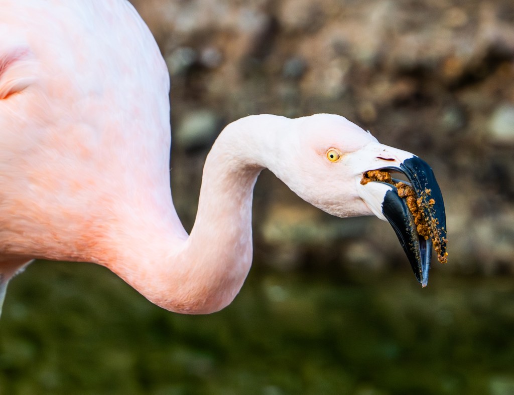
There are few places in Southern California where raw coastal beauty and high-speed wildlife drama come together as seamlessly as Torrey Pines State Natural Reserve. Known for its windswept cliffs, rare pine trees, and sweeping ocean views, this stretch of coastline is also home to one of the fastest animals on Earth—the Peregrine Falcon.
A Perfect Home Above the Pacific
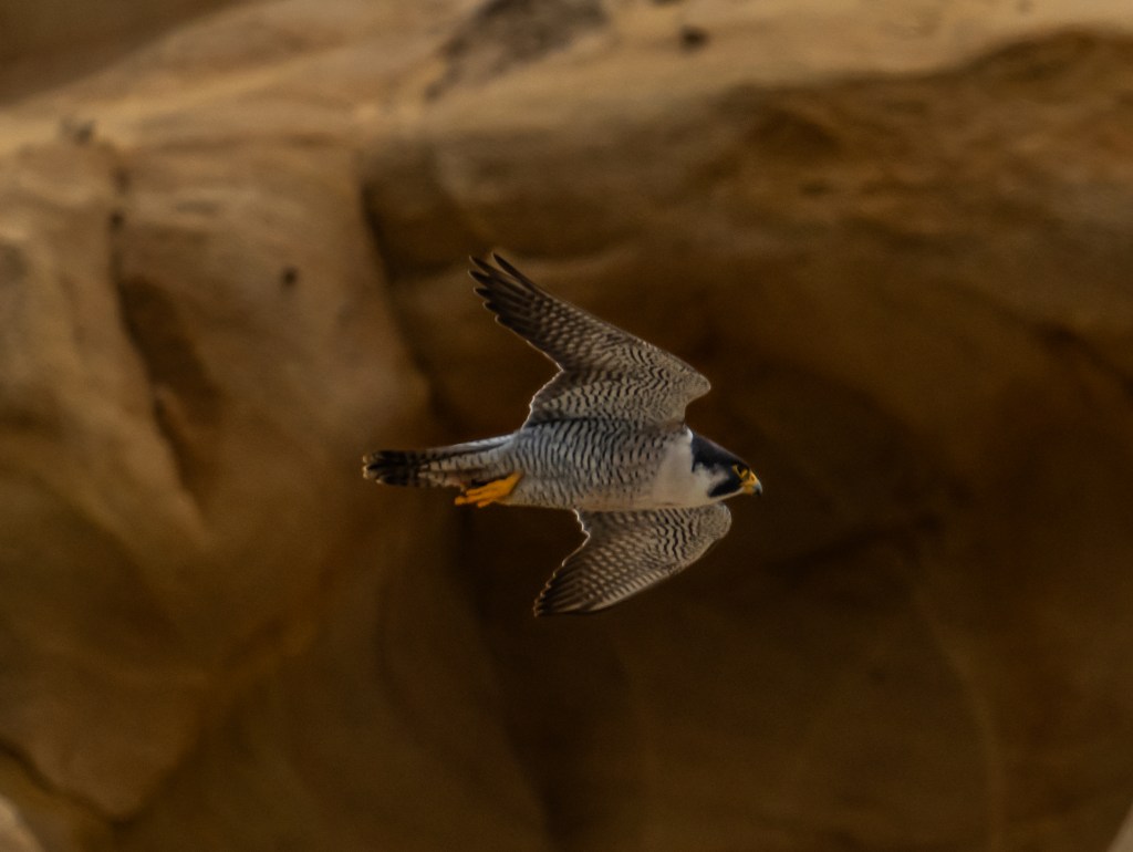
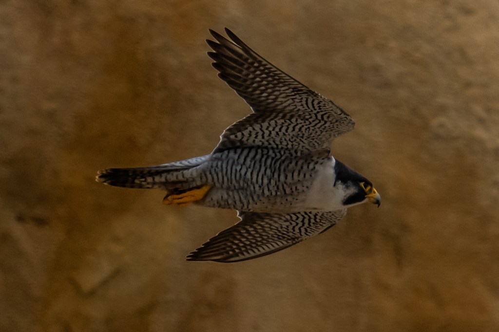
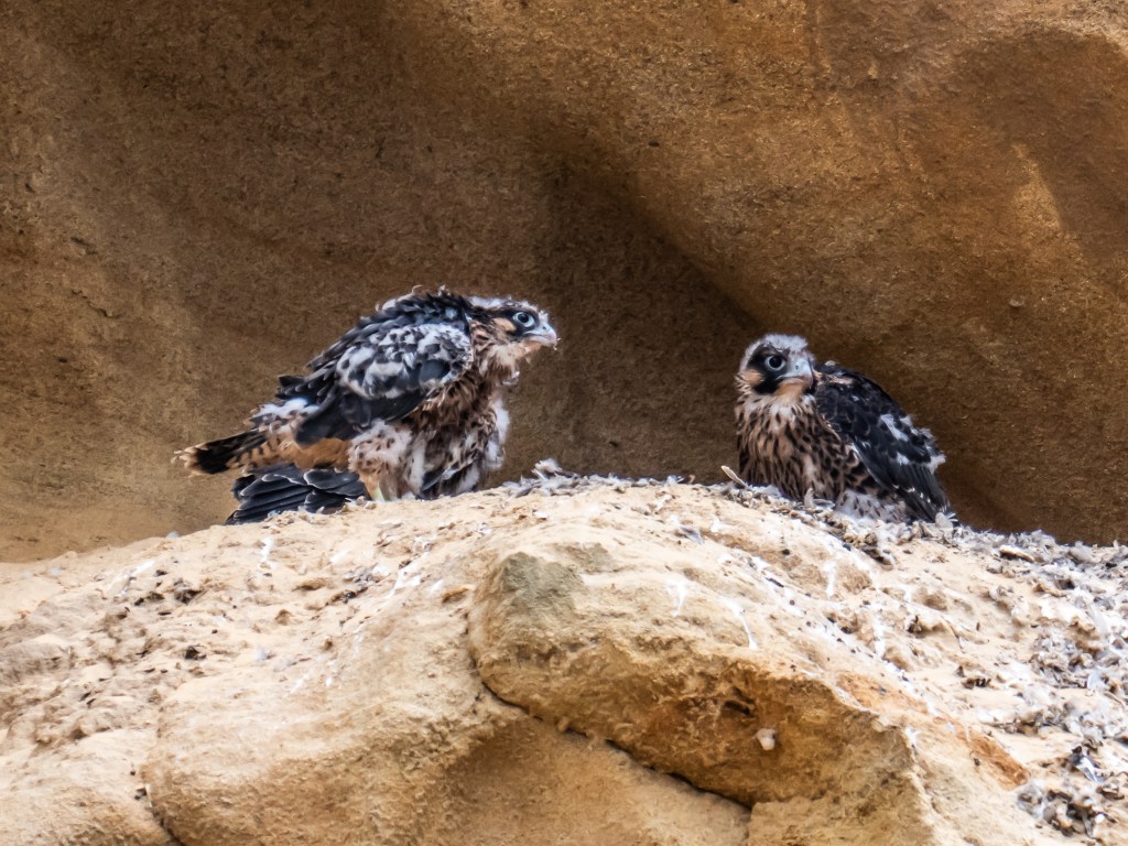
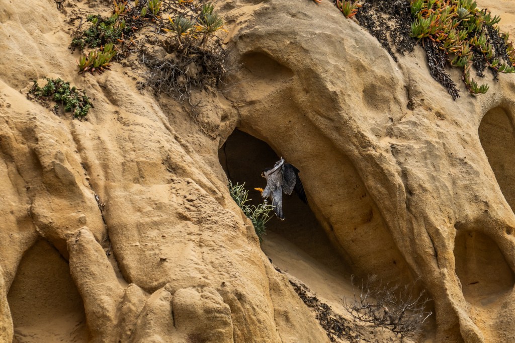
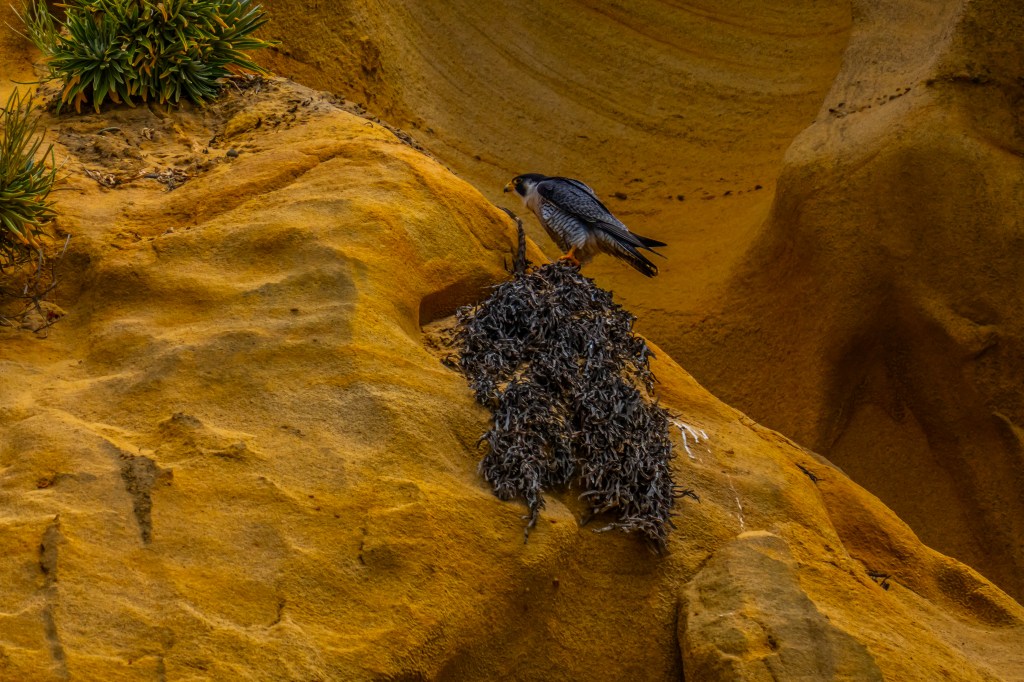
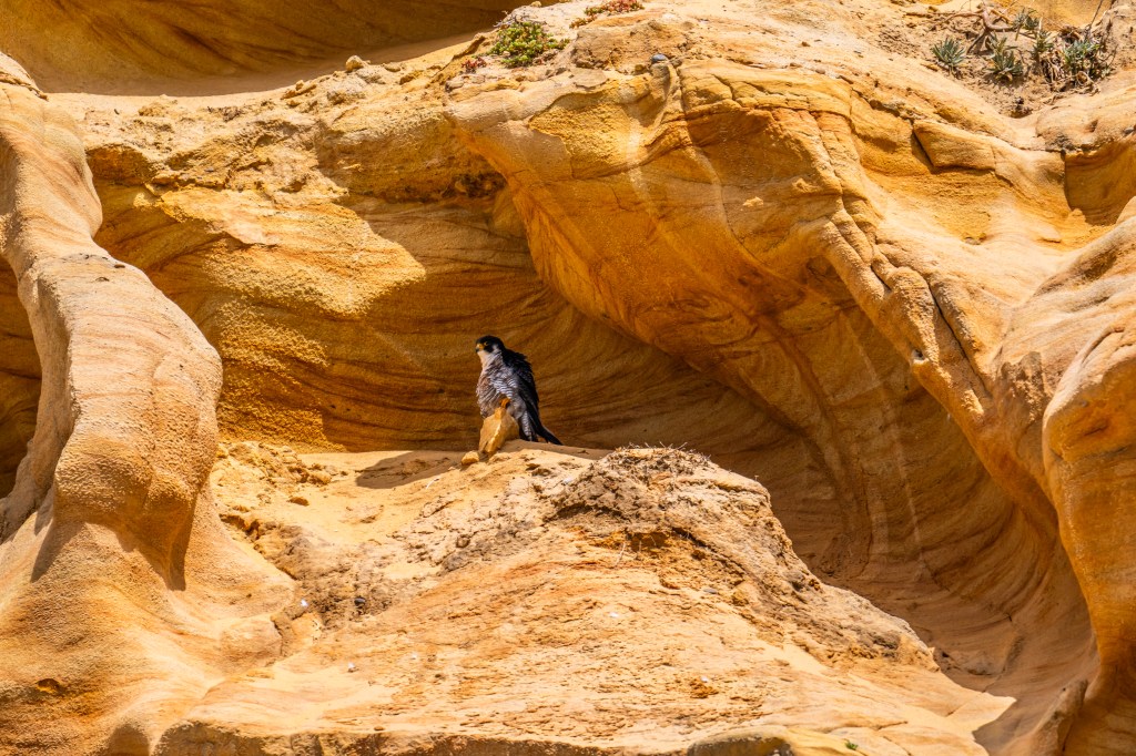
The sandstone cliffs of Torrey Pines State Beach provide ideal nesting habitat for peregrine falcons. High ledges offer safety from predators and unobstructed views of the skies and shoreline below. From these vantage points, falcons can scan for prey—shorebirds, pigeons, and small seabirds—before launching into action.
Unlike many birds of prey that build large nests, peregrines prefer a simple scrape in gravel or dirt along cliff edges. It’s minimalist, but perfectly suited for life on the edge.
The Fastest Dive in Nature
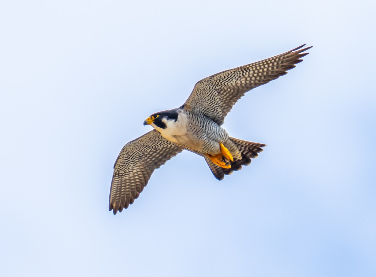
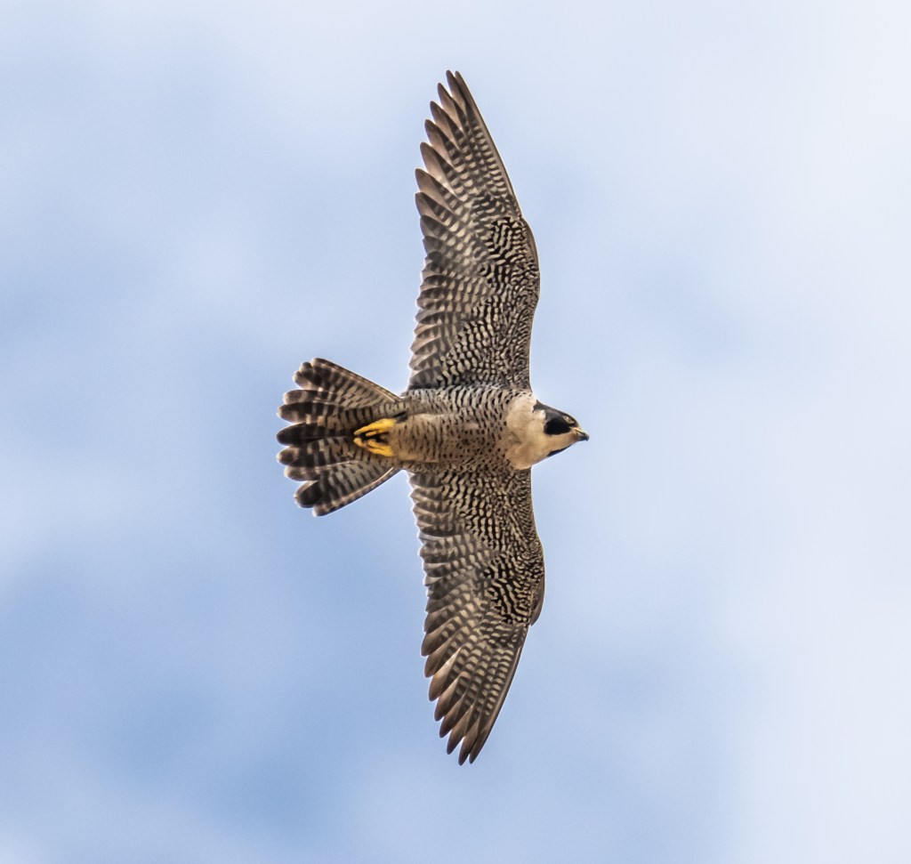
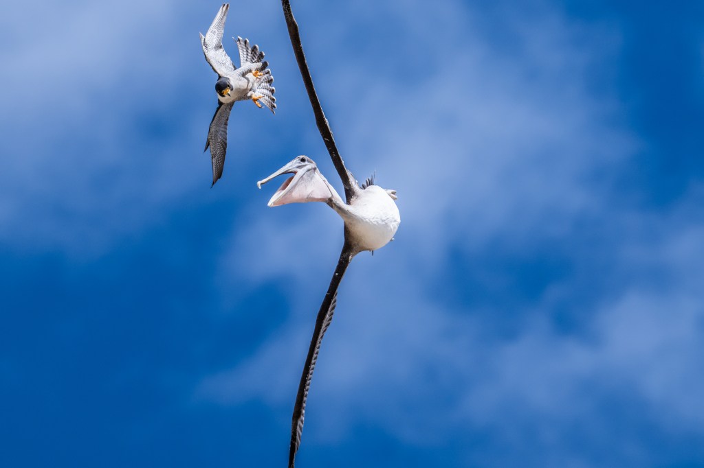
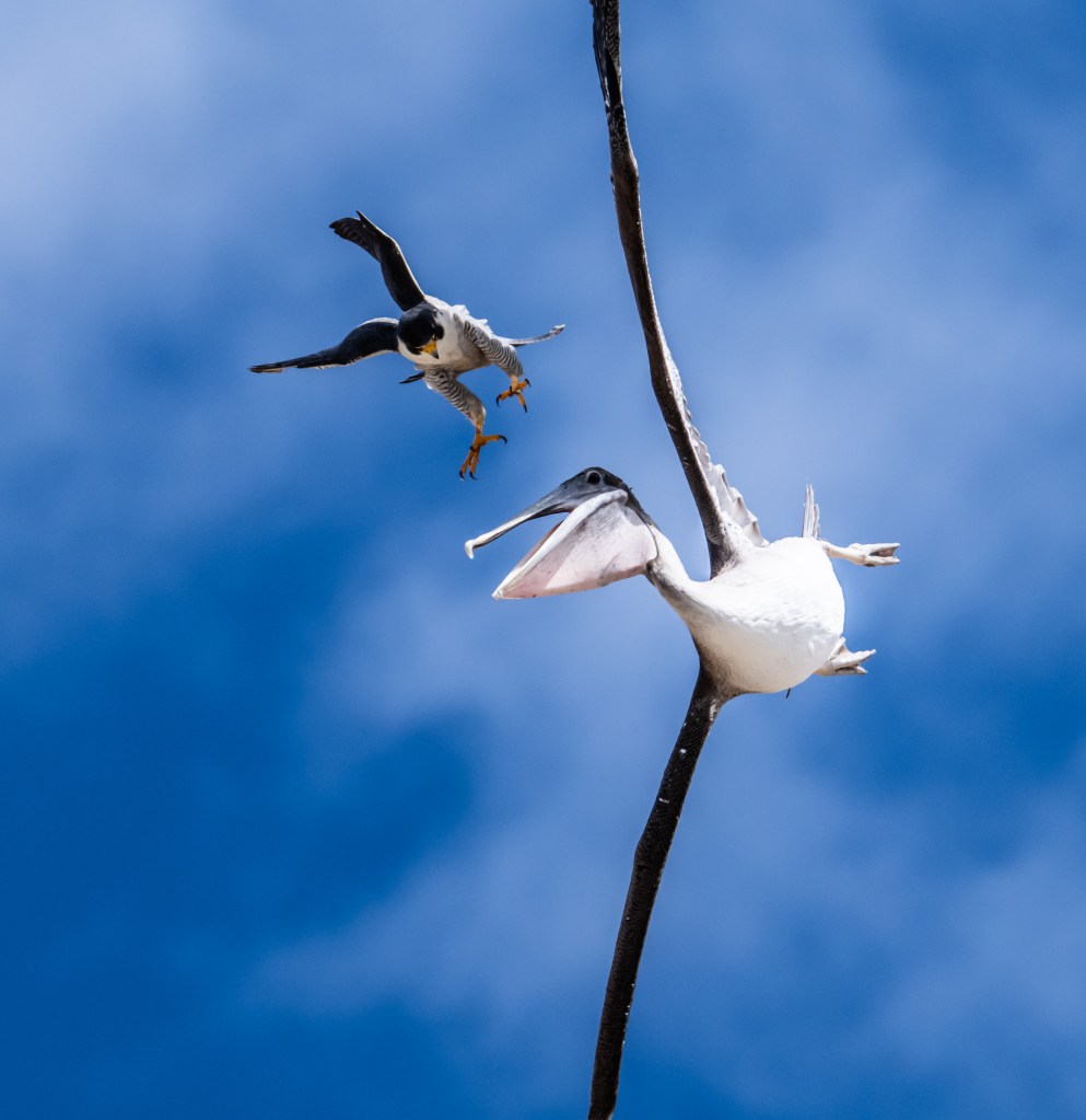
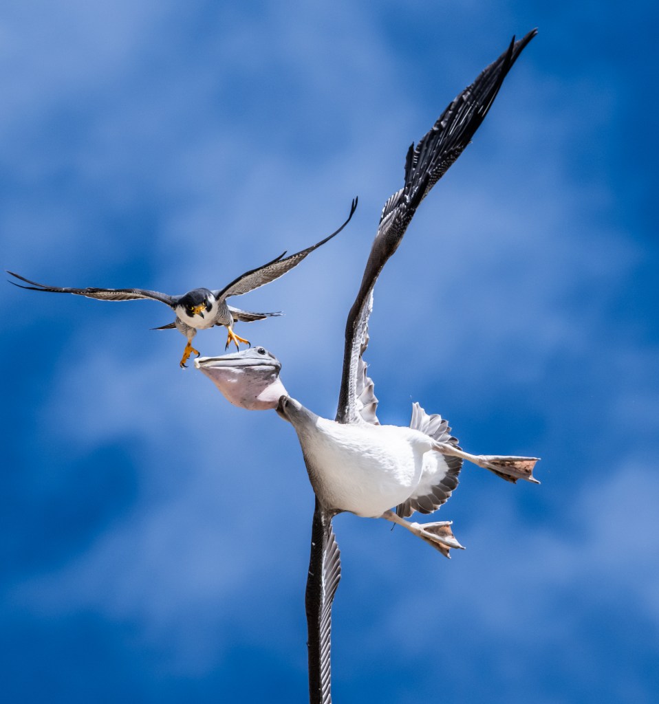
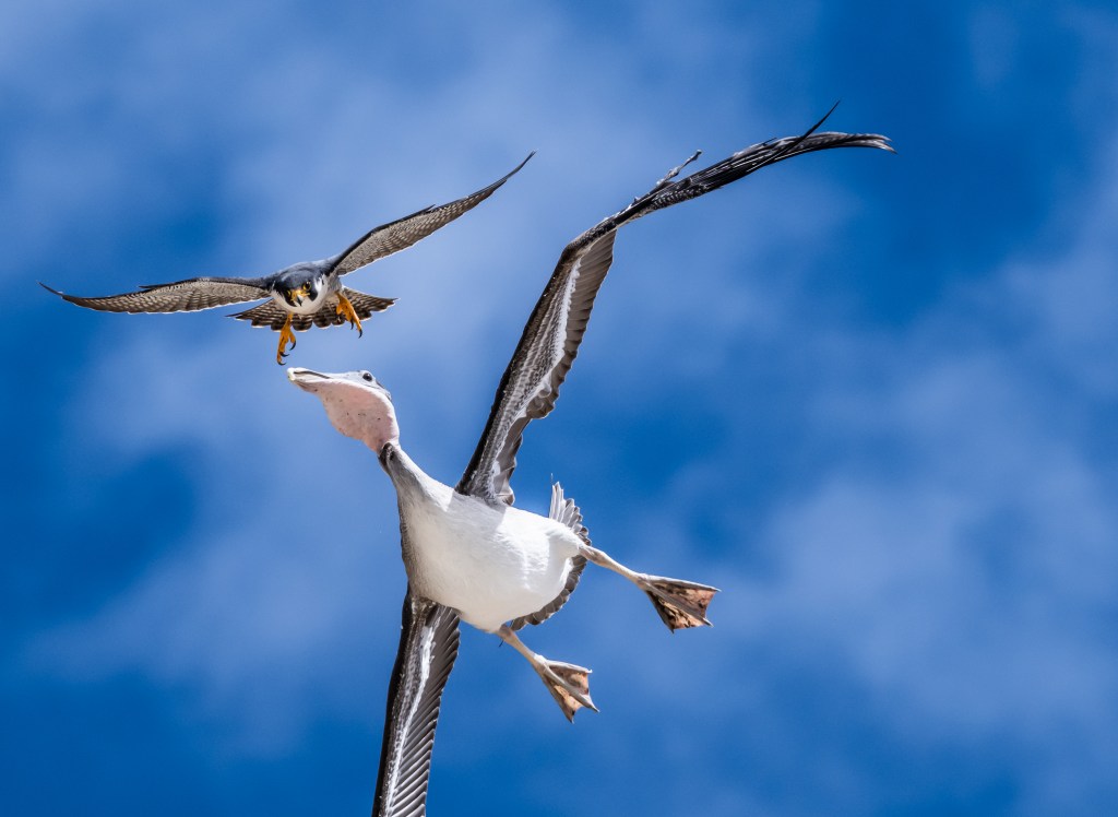
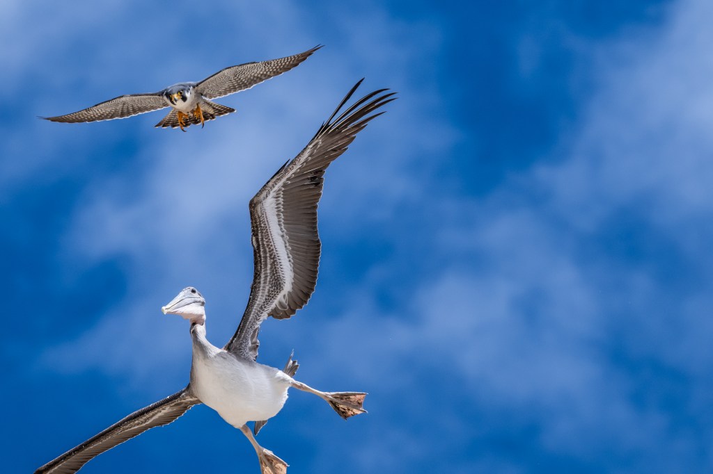
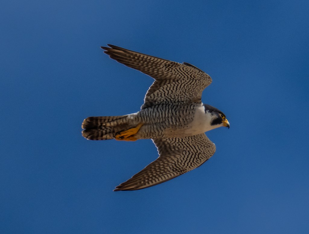
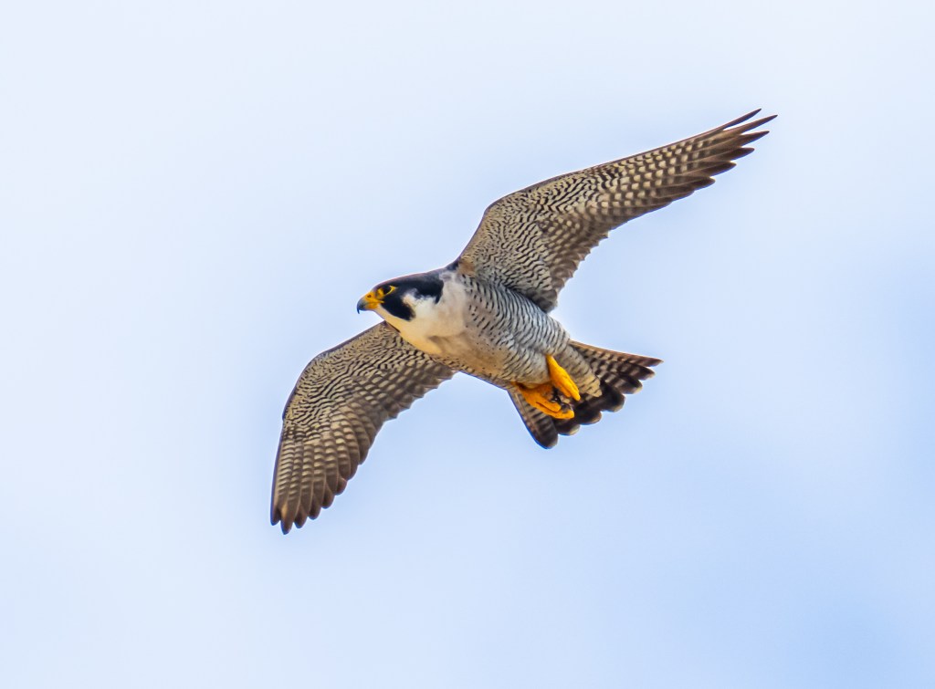
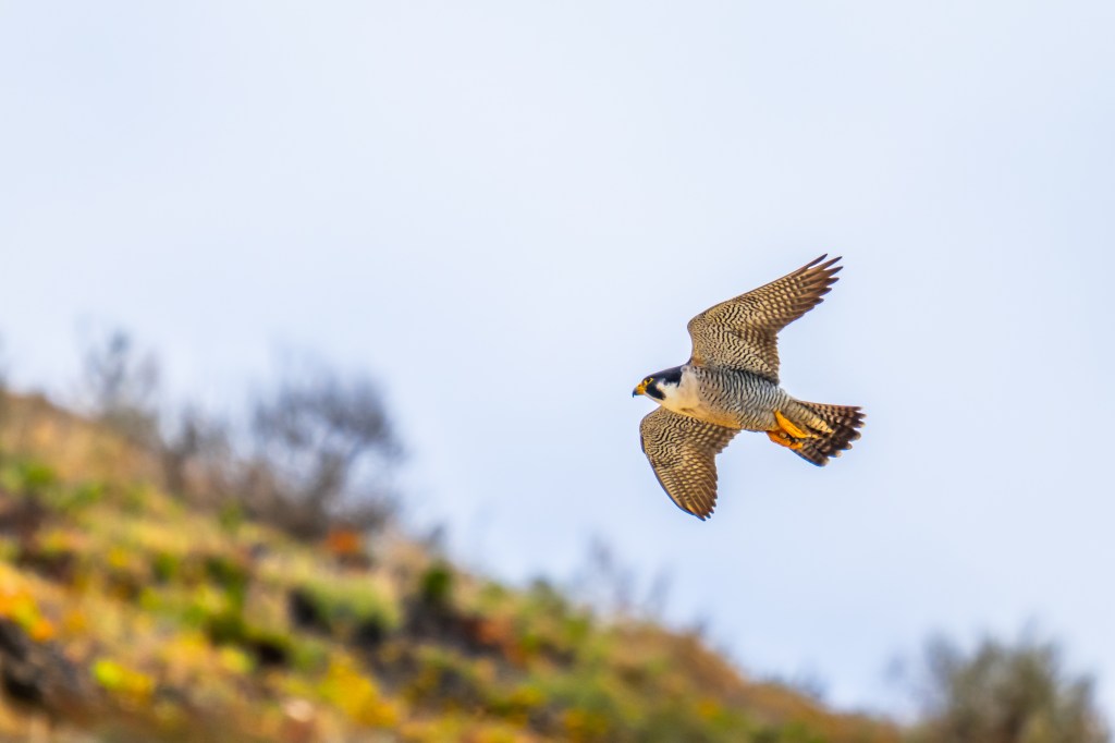
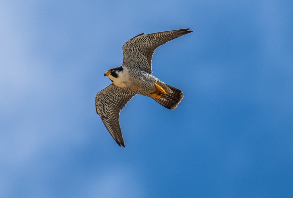
What makes peregrine falcons truly legendary is their speed. During a hunting dive—known as a stoop—they can exceed 200 miles per hour, making them the fastest animal on the planet. Watching one descend along the cliffs at Torrey Pines is unforgettable: a blur of motion, a sudden strike, and then silence again as the ocean continues to roll below.
Their streamlined bodies, pointed wings, and powerful talons are all built for this precise, high-speed hunting style.
A Conservation Comeback
The presence of peregrine falcons at Torrey Pines is also a conservation success story. In the mid-20th century, populations across North America declined sharply due to pesticide use, especially DDT. Thanks to bans on harmful chemicals and dedicated recovery efforts, peregrines have made a remarkable comeback.
Today, spotting one soaring above the reserve is a reminder of what conservation can achieve.
When and Where to Look
If you’re hoping to photograph or observe peregrine falcons at Torrey Pines, timing and patience are key:
- Best time of day: Early morning or late afternoon, when birds are most active
- Best locations: Cliffside trails like the Razor Point and Beach Trail areas
- Breeding season: Spring into early summer, when activity near nesting sites increases
Look for fast, direct flight patterns and sharp wingbeats. Peregrines are often seen gliding along cliff edges or perched high above the trails.
Photography Tips for Capturing the Hunt
For photographers, peregrine falcons offer both a challenge and a reward:
- Bring a telephoto lens (at least 300mm) to safely capture distant birds
- Use a fast shutter speed to freeze motion during flight
- Watch the wind—falcons often face into it when hovering or preparing to dive
- Be ready—hunts happen quickly and without warning
Even if you don’t capture the perfect shot, the experience alone is worth it.
Respecting Wildlife and Habitat
As exciting as it is to see peregrine falcons up close, it’s important to respect their space. Stay on designated trails, keep a safe distance from nesting areas, and follow any posted closures during breeding season. These protections help ensure the falcons continue to thrive along this fragile coastline.
A Moment Worth Waiting For
At Torrey Pines, the landscape itself is dramatic—but the sky adds another dimension. A quiet walk along the cliffs can suddenly turn into a front-row seat to one of nature’s most incredible displays of speed and precision.
Whether you’re a birder, photographer, or casual visitor, catching a glimpse of a peregrine falcon here is something you won’t forget. It’s a reminder that even in a place known for its scenery, the real magic is often moving just above you.