Boulder Park: Folk Art Meets Desert Rock
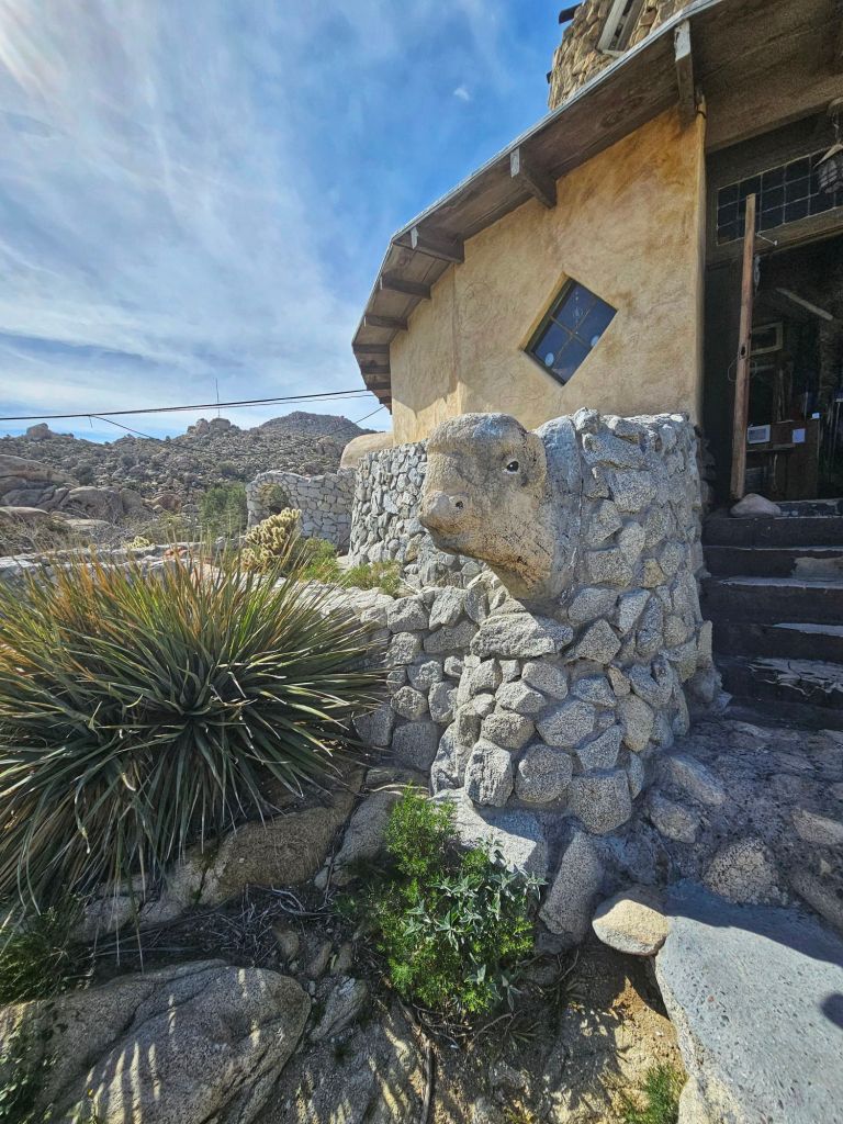
Just beside the tower lies the unforgettable Boulder Park — a surreal sculpture garden carved directly into massive quartz-granite boulders. During the 1930s, an out-of-work engineer named Merle Ratcliff spent nearly two years chiseling whimsical shapes into the stones: lizards, skulls, animals, and mysterious figures emerge from the rock as if sprung from the desert itself. This folk art environment brings a playful and slightly surreal contrast to the stark landscape.
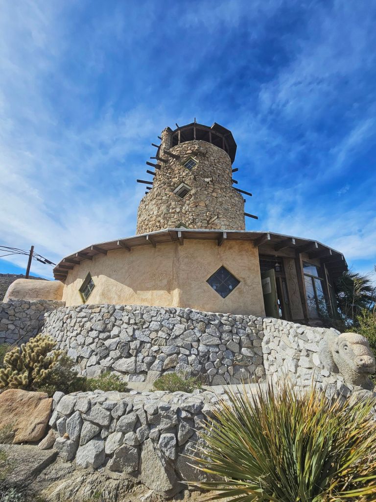
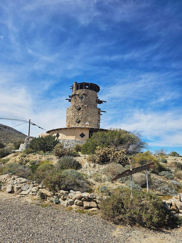
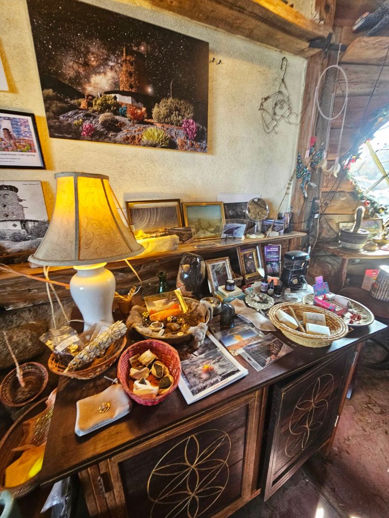
the Desert View Tower is a 5 story stone building built in the 1920s. Its less a mile from Interstate 8 in Ocotillo, Ca #view#desert#california#landscape#travel
Desert View Tower Open 7 Days a week from 8am to 6pm. To climb to the top of the tower or walk through boulder park will cost you $9.50
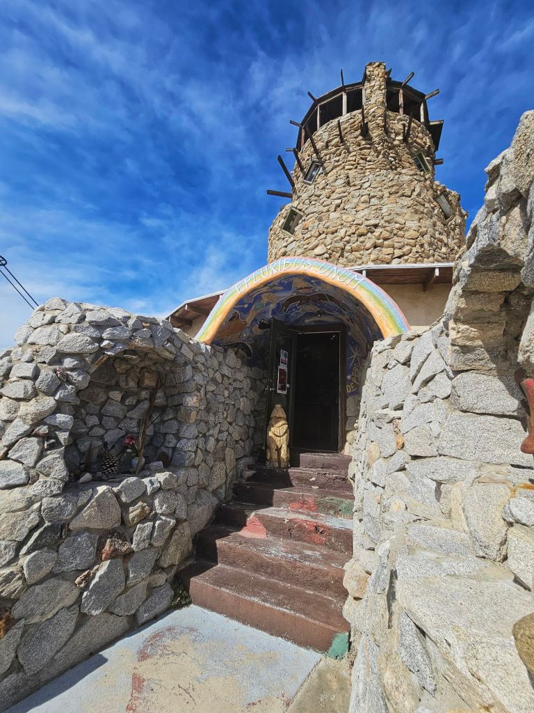
Tucked amid the rugged beauty of Southern California’s In-Ko-Pah Mountains, just off Interstate 8 near Jacumba Hot Springs, stands one of the most fascinating and offbeat roadside attractions in the American Southwest: the Desert View Tower. This striking stone structure has welcomed travelers for more than a century, offering sweeping desert views, folk-art charm, and a captivating slice of regional history.
A Monument to Pioneers and Road Travelers
The Desert View Tower was built between 1922 and 1928 by San Diego entrepreneur Bert Vaughn, who wanted to honor the hardy pioneers, railroad builders, and early road crews who first pushed through this arid landscape. Perched at roughly 3,000 feet in elevation, it was originally a roadside beacon along Old U.S. Route 80 — guiding and inviting travelers as automobiles began to shape the American West.
Boulder Park: Folk Art Meets Desert Rock
Just beside the tower lies the unforgettable Boulder Park — a surreal sculpture garden carved directly into massive quartz-granite boulders. During the 1930s, an out-of-work engineer named Merle Ratcliff spent nearly two years chiseling whimsical shapes into the stones: lizards, skulls, animals, and mysterious figures emerge from the rock as if sprung from the desert itself. This folk art environment brings a playful and slightly surreal contrast to the stark landscape.
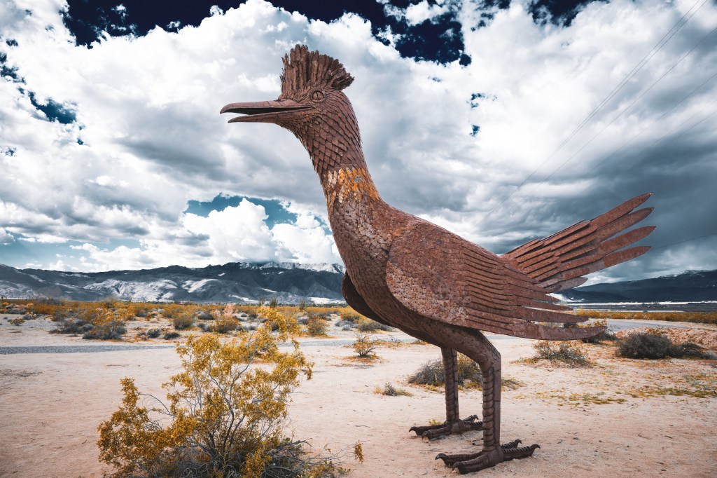
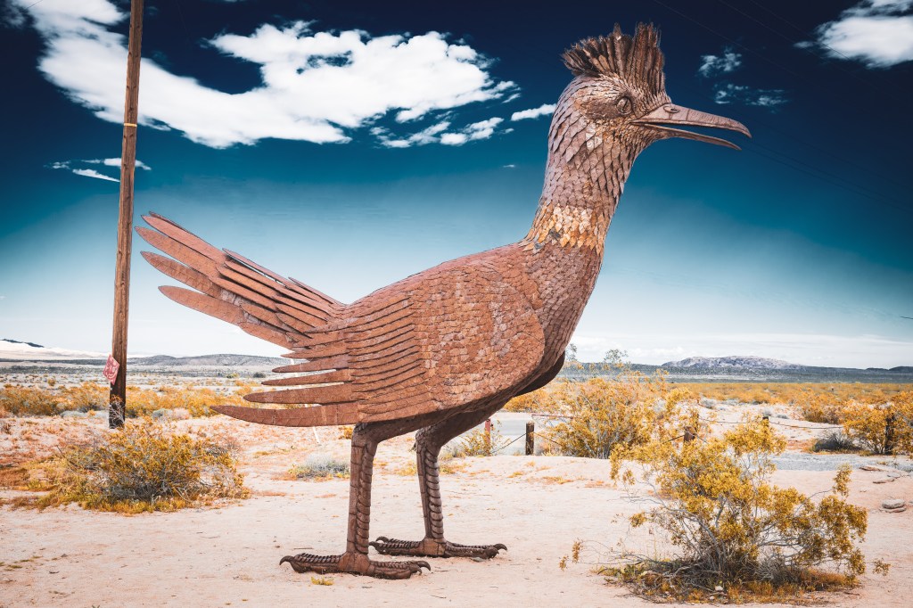
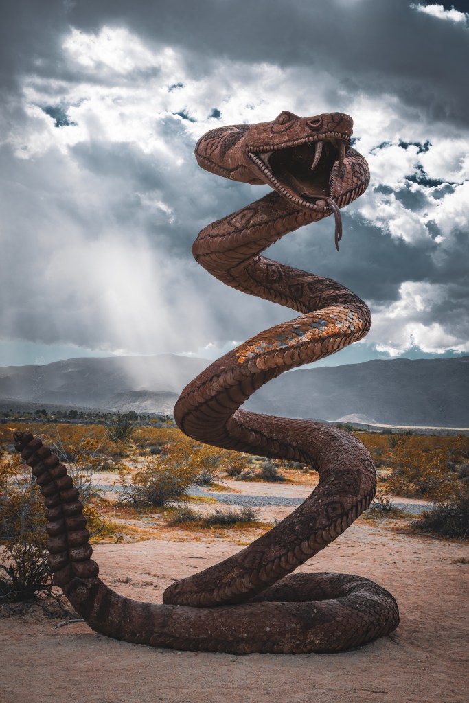
If you’re looking for an unforgettable blend of art, nature, and imagination, Galleta Meadows in Borrego Springs, California is a place that deserves a spot on every adventurer’s bucket list. Nestled just outside Anza-Borrego Desert State Park, this sprawling open-air sculpture garden is unlike any traditional museum — and every visit feels like stumbling into a storybook come to life.
Galleta Meadows isn’t fenced off or hidden behind ticket booths. Instead, it’s a free-to-explore desert landscape dotted with more than 130 massive metal sculptures that seem to roam timelessly across the sandy terrain. From prehistoric beasts to wild horses and mythical serpents, these striking installations create a sweeping visual narrative that’s both whimsical and awe-inspiring.
Each piece is welded from scrap metal and crafted with incredible attention to detail — whether it’s the curling lashes of an elephant or the textured scales of a dragon weaving through the earth.
The creative force behind Galleta Meadows is Ricardo Breceda, a self-taught sculptor whose journey from everyday jobs to art world acclaim is as compelling as his creations themselves. Born in Durango, Mexico, Breceda wasn’t a trained artist at all — he worked as a construction worker and cowboy boot salesman before a life-changing moment steered him in a new direction.
Philanthropist Dennis Avery discovered Breceda’s work and invited him to create sculptures for his Galleta Meadows Estate. The partnership transformed this once-quiet desert into one of the most captivating outdoor art installations in the United States.
What You’ll See at Galleta Meadows
The sculptures are thoughtfully themed around three ideas: fossil treasures, desert nature and history, and flights of whimsical fantasy. As you wander or drive through the area, you’ll encounter:
🦕 Prehistoric creatures — From mammoths and saber-toothed cats to enormous dinosaurs.
🐎 Wildlife and desert scenes — Horses mid-gallop, tortoises creeping along, and bighorn sheep poised against the sky.
🐉 The legendary serpent — A dramatic 350-foot-long creation that seems to slither right through the sand, its head and tail rising like an ancient desert titan.
👤 Historical figures — Human characters like miners, padres, and farm workers add narrative layers to the art experience.
Every sculpture interacts with its environment — glowing fiery orange at sunset or silhouetted under a blanket of stars — giving photographers and storytellers endless inspiration.
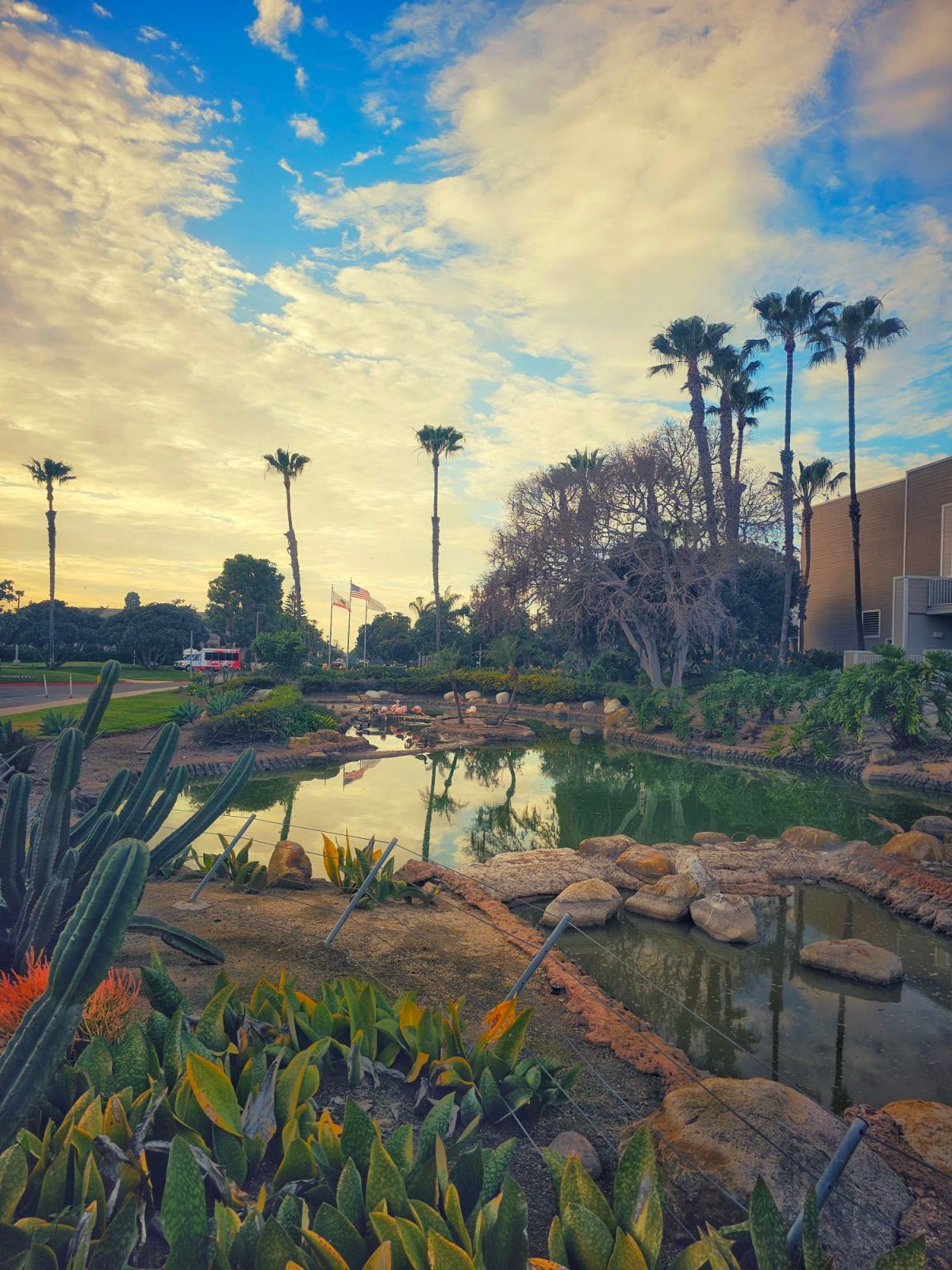
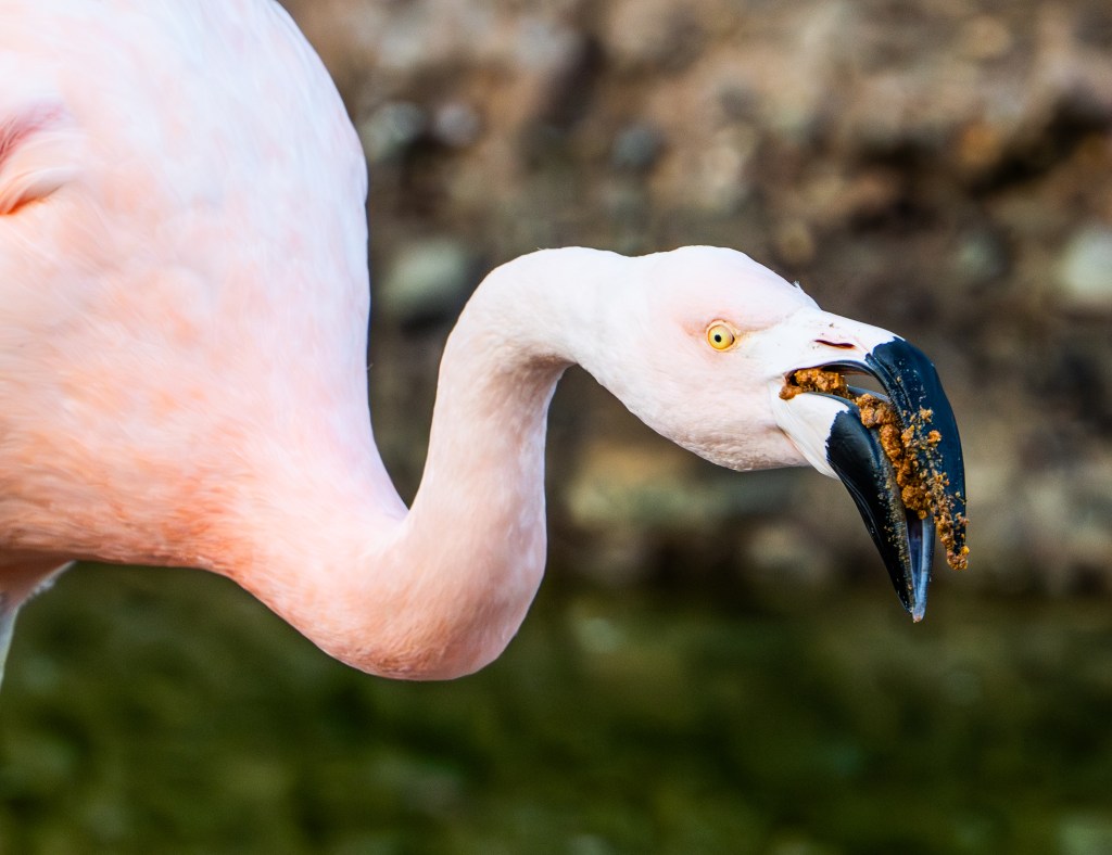
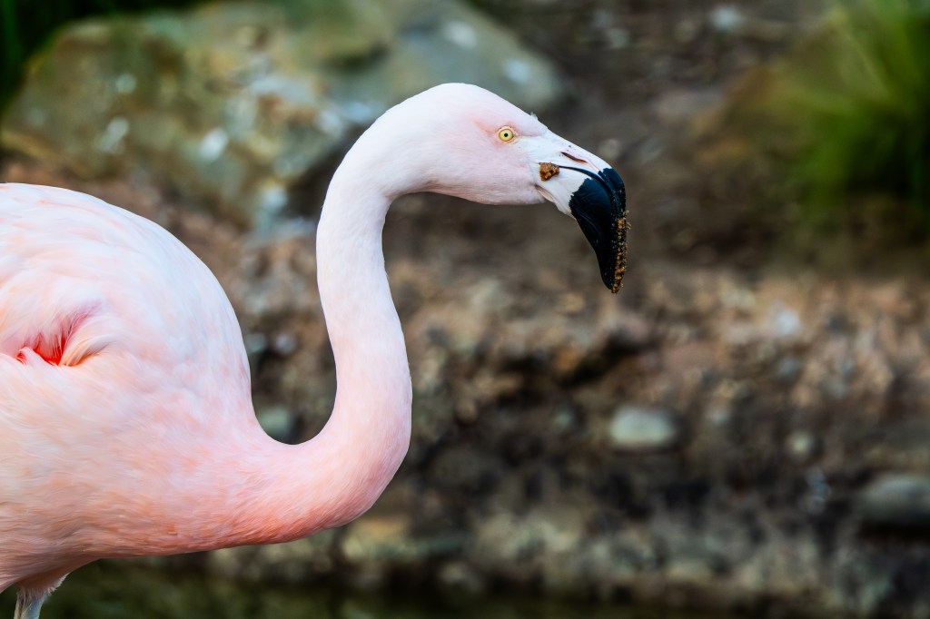
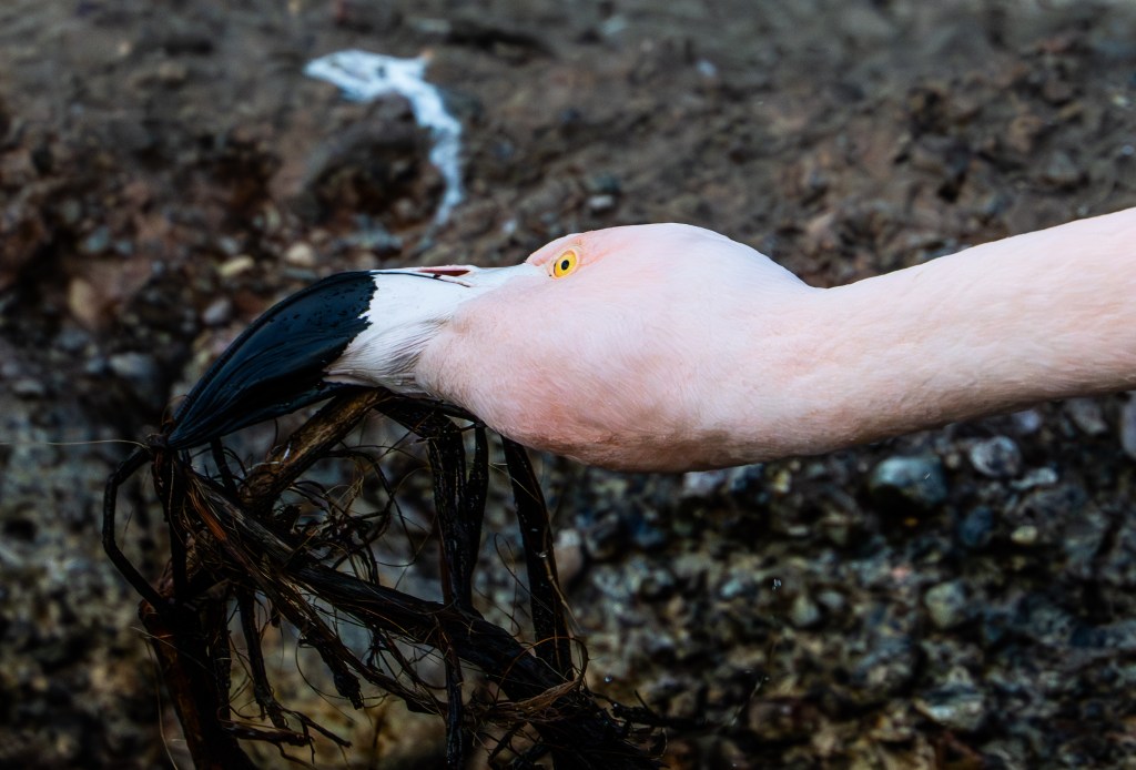
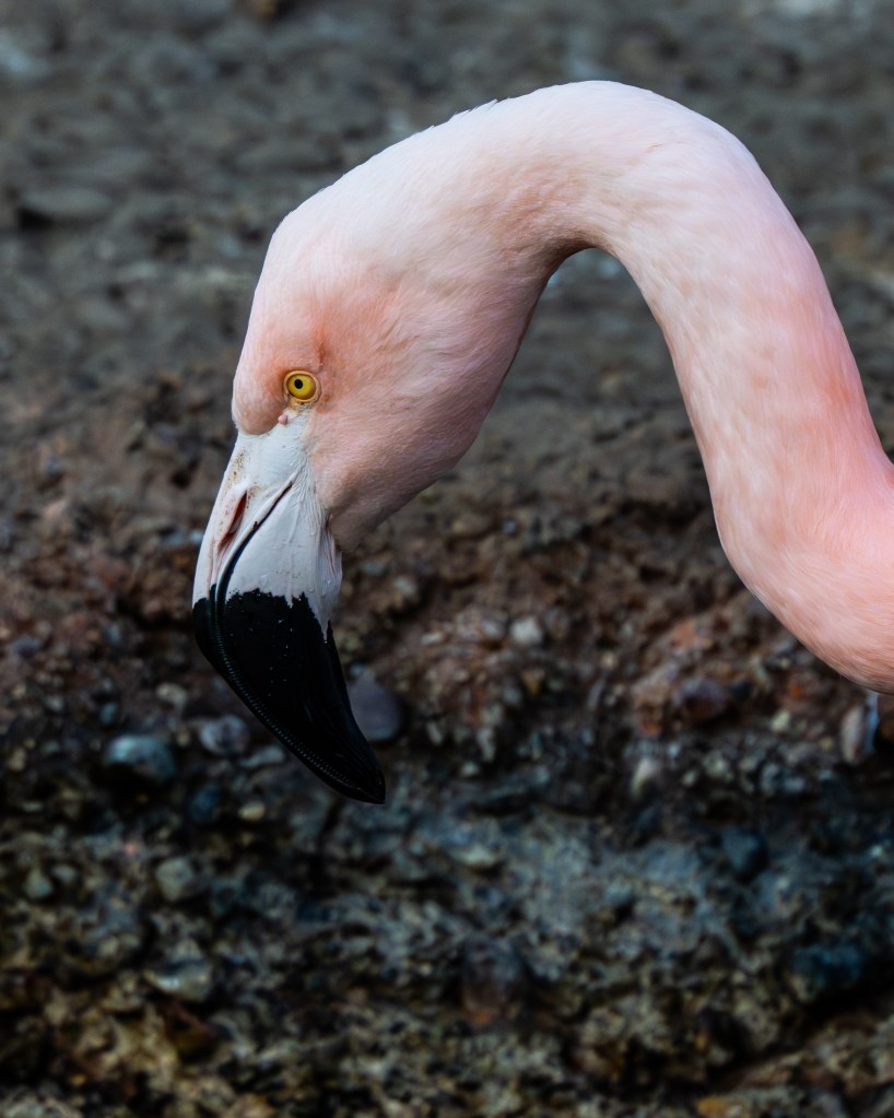
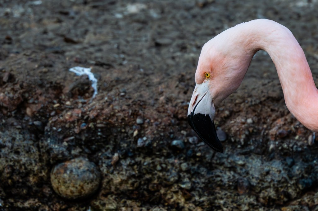
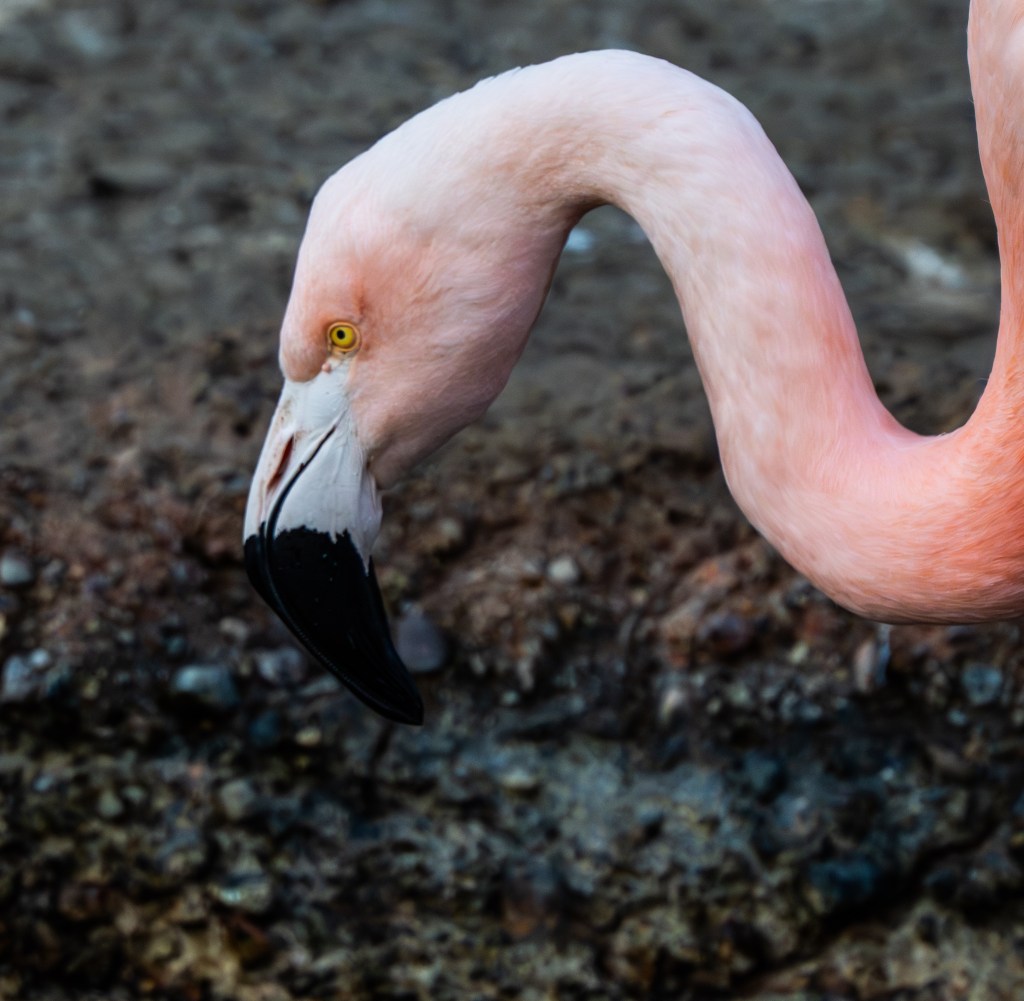
Right near the entrance of the Marriott Coronado Resort and Spa area series of fresh water ponds where you can a group of flamingos strutting, preening and standing in the shallows. These striking birds — often identified as Chilean flamingos— bring an enchanting splash of color to the tropical landscaping and are a favorite photo opportunity for guests and passersby alike.
While Coronado’s golden beaches and sparkling bay views are a draw in themselves, the flamingos offer something extra: a touch of whimsy and wonder. They’re known to hang out right by the Lagoon area accessible from the Bayshore Bikeway, so even if you aren’t staying at the hotel, a quiet stroll along the waterfront could lead to a charming flamingo sighting.
📸 Why Visitors Love Them
Iconic photo ops: Kids and adults alike pause to snap pictures of the elegant birds — their vibrant pink feathers make a lovely contrast against the deep greens of the resort landscaping and the blue backdrop of San Diego Bay.
Unexpected wildlife moment: It’s not every day you come across flamingos in Southern California, so they feel like a special little secret of Coronado.
Accessible to all: You don’t need a room key to enjoy the flamingos — curious visitors can spot them from nearby public paths near the ferry landing and waterfront promenade.
If you are not a guest of the hotel or do not want to pay the resort parking fee you will have to find street parking in front of the hotel along Glorietta Boulevard. Park south of the resort at Tidelands Park and walk north along the Bay Shore Bike Path. Or lastly park north of the resort ant the Coronado Ferry Landing Parking lot and walk south along the bay shore bike path.
The freshwater ponds are located to the right of the main hotel entrance on the south side of the building.
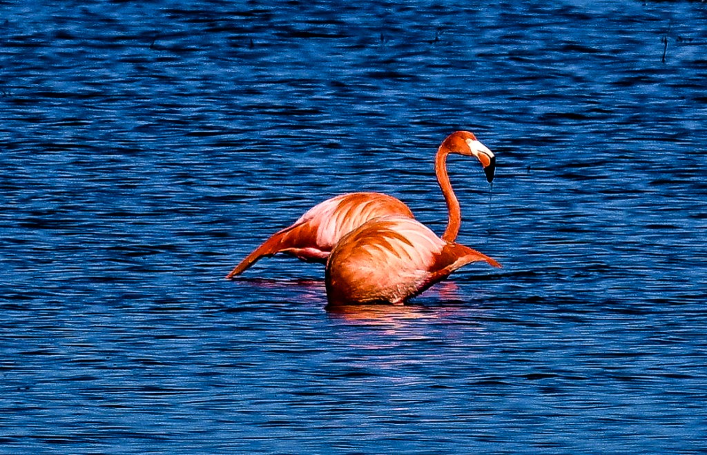
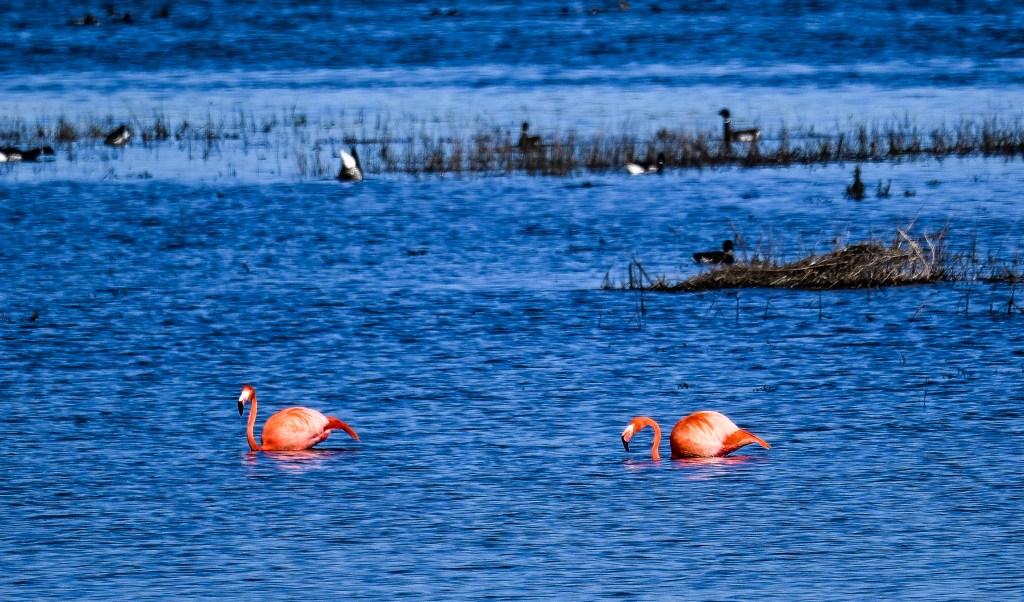
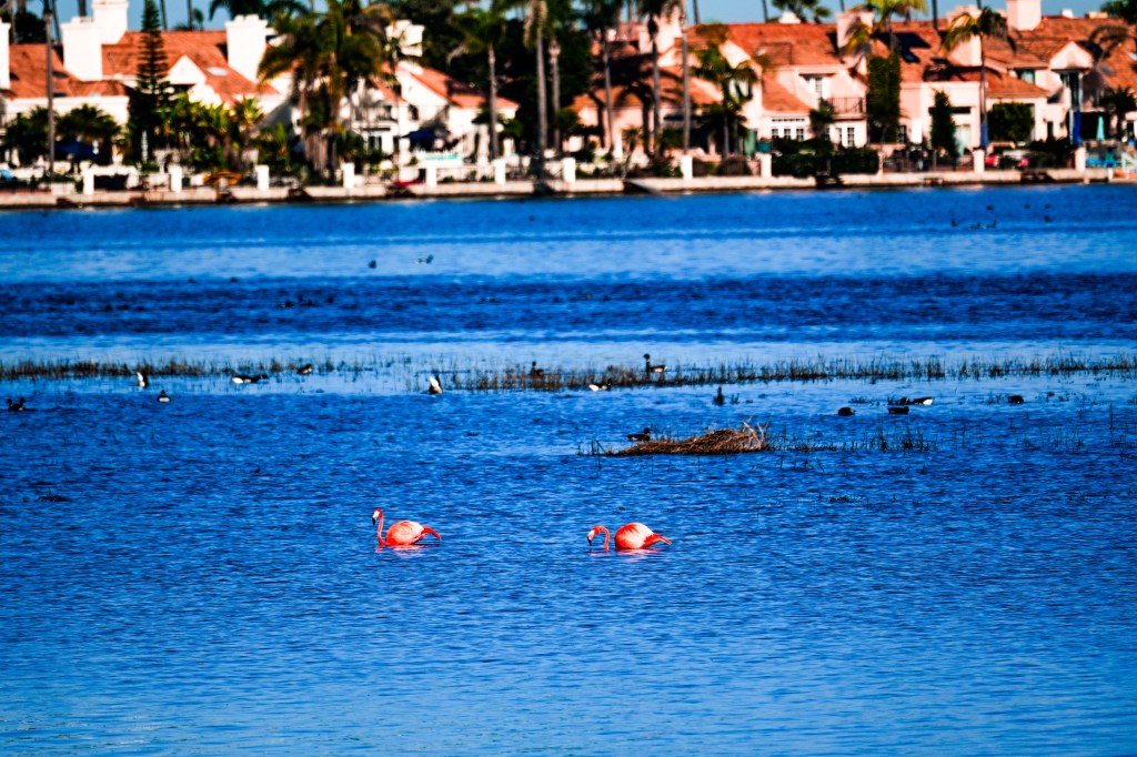
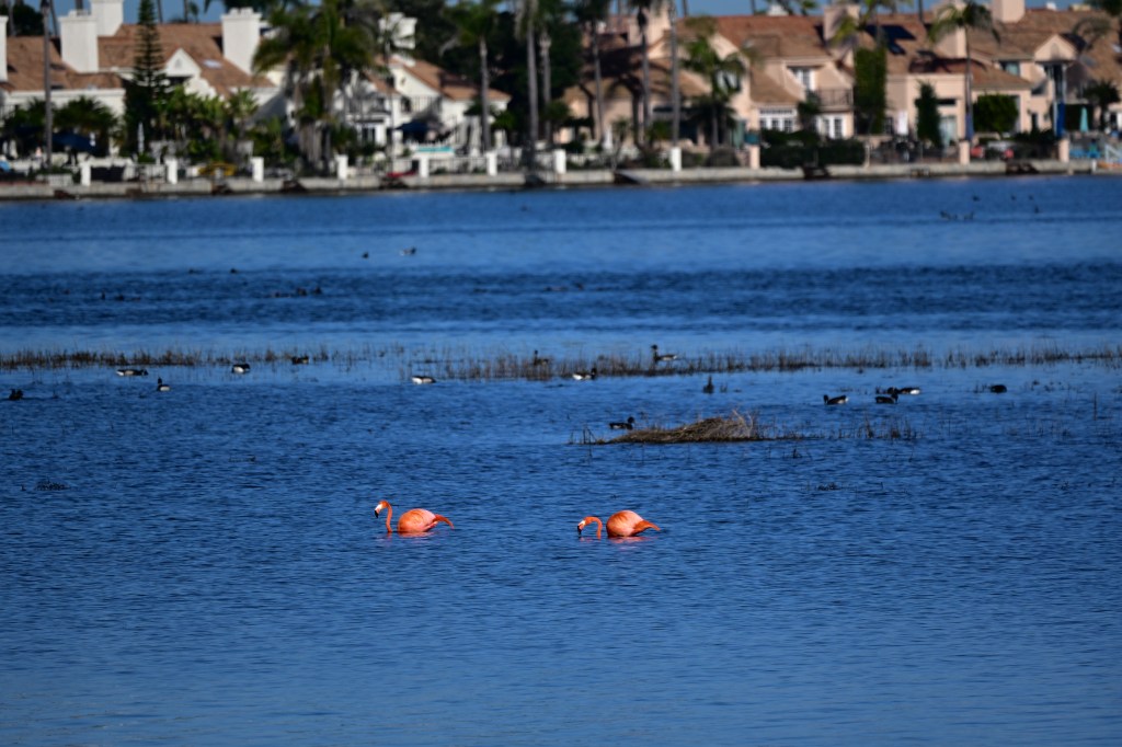
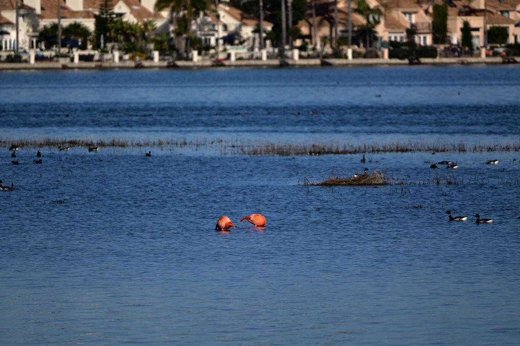
Flamingos in San Diego Bay: Rare Sightings Along a Familiar Shoreline
San Diego Bay is home to more than 300 bird species throughout the year, but flamingos are not among the region’s native wildlife. Still, on rare occasions, observers have reported flamingos along the bay’s shallow edges, drawing attention from birders and curious onlookers alike.
These sightings, while unusual, are not without explanation. Over the weekend I was driving southbound on State Route 75 from Coronado to Imperial Beach when I spotted 2 pink dots off to my left in the marsh shallows. I turned around in Imperial Beach, headed north to the Bike Path parking lot accessible from NB 75. And walk north for about 15min to find the two flamingos about 200 yards off shore. It was High Tide at the time which flooded the shallow marsh and coaxed the flamingos and other shore birds closer to shore.
Not Native, but Occasionally Present
Flamingos do not naturally occur in Southern California. Their typical range includes the Caribbean, parts of South America, Africa, and the Galápagos Islands. Experts generally agree that flamingos seen in San Diego County are likely birds that escaped or dispersed from captive populations rather than true wild migrants.
In the mid-20th century, flamingos were commonly kept in open-air zoo exhibits and private collections. Some individuals were able to fly beyond their enclosures and settle into nearby wetlands. A small number adapted to local conditions and remained in Southern California for extended periods, occasionally appearing in bays, lagoons, and salt ponds.
Habitat Conditions in San Diego Bay
Despite its urban setting, San Diego Bay contains habitat features that can support flamingos. Shallow waters, mudflats, and salt ponds provide feeding opportunities similar to those found in the species’ native environments. Flamingos feed on algae, brine shrimp, and other small invertebrates, filtering food from the water using specialized bills.
The bay’s salt works and managed wetlands, particularly in the southern portion of the bay, offer stable water levels and limited wave action—conditions suitable for wading birds that rely on calm, shallow areas.
Public Interest and Documentation
When flamingos appear in the bay, the sightings are typically well documented. Photographs and field notes are often shared through birding networks and community science platforms, where experts review and confirm observations. These records help distinguish between escaped birds, long-term residents, and misidentified species.
While flamingos attract attention, wildlife officials generally discourage close approaches. Maintaining distance reduces stress on the birds and minimizes the risk of disturbance to surrounding wildlife.
A Reminder of the Bay’s Ecological Value
Though flamingos are not part of San Diego Bay’s native ecosystem, their presence highlights the importance of coastal wetlands. The same habitats that occasionally support a flamingo also sustain migratory shorebirds, waterfowl, and endangered species year-round.
Even rare and unexpected sightings underscore the bay’s role as a critical refuge in a heavily developed region—one that continues to support a wide range of avian life.
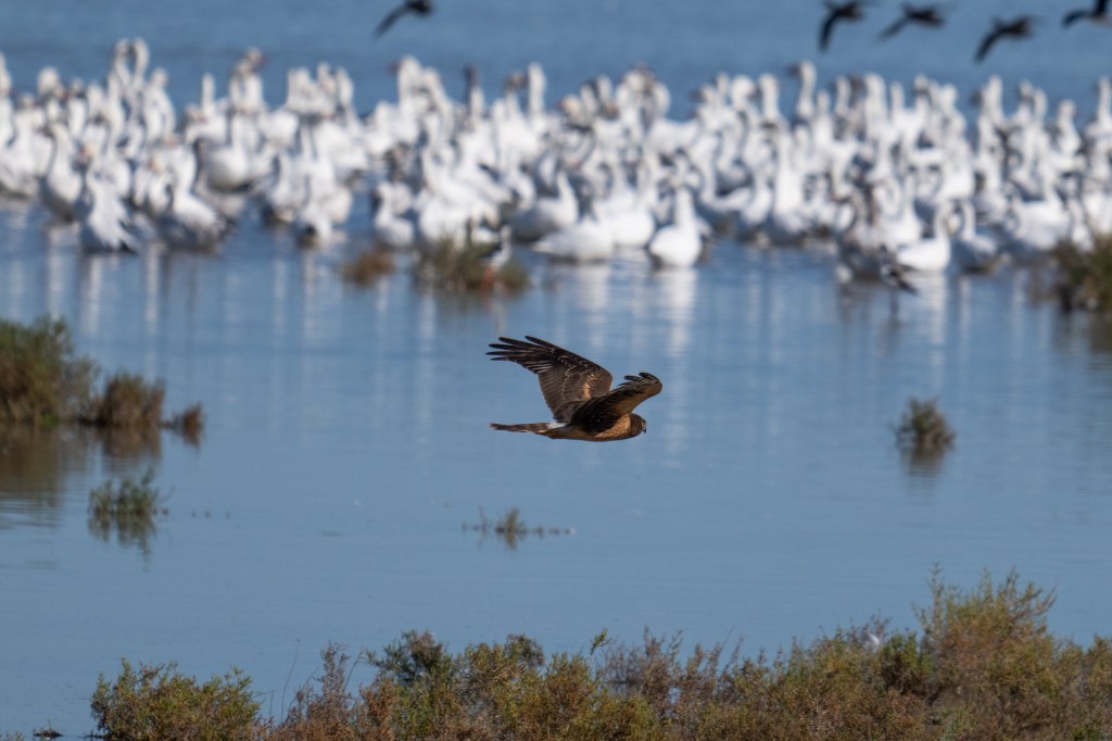
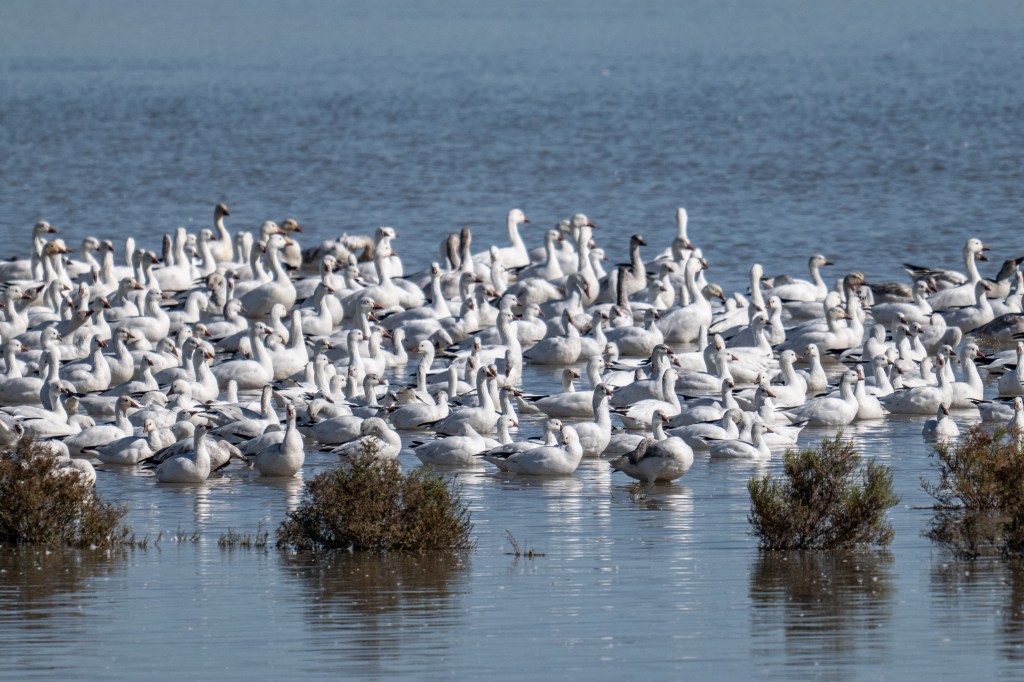
Stretching along the southern shore of the Salton Sea, the Sonny Bono Salton Sea National Wildlife Refuge is one of Southern California’s most surprising and important wildlife destinations. What looks like a stark desert landscape at first glance quickly reveals itself as a vital oasis for birds, mammals, and migrating wildlife traveling the Pacific Flyway.
A Refuge Born from Agriculture and Conservation
The refuge was established in 1930, originally to provide habitat for migratory birds drawn to agricultural runoff in the Imperial Valley. In 1998, it was renamed in honor of Sonny Bono, the late congressman and entertainer who played a key role in expanding and protecting public lands in California.
Today, the refuge spans more than 37,000 acres of managed wetlands, desert scrub, and agricultural fields. These habitats work together to support wildlife in a region where natural water sources are scarce.
A Birding Hotspot of International Importance
If you love birds, this place is legendary. More than 400 bird species have been recorded here, making it one of the most significant birding locations in the western United States.
Depending on the season, visitors may spot:
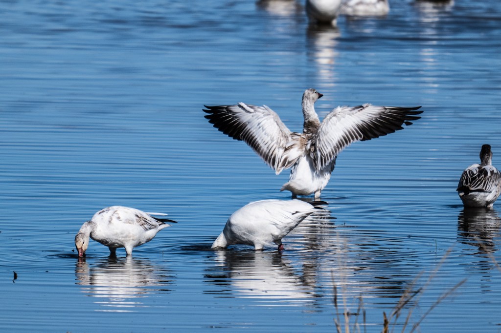
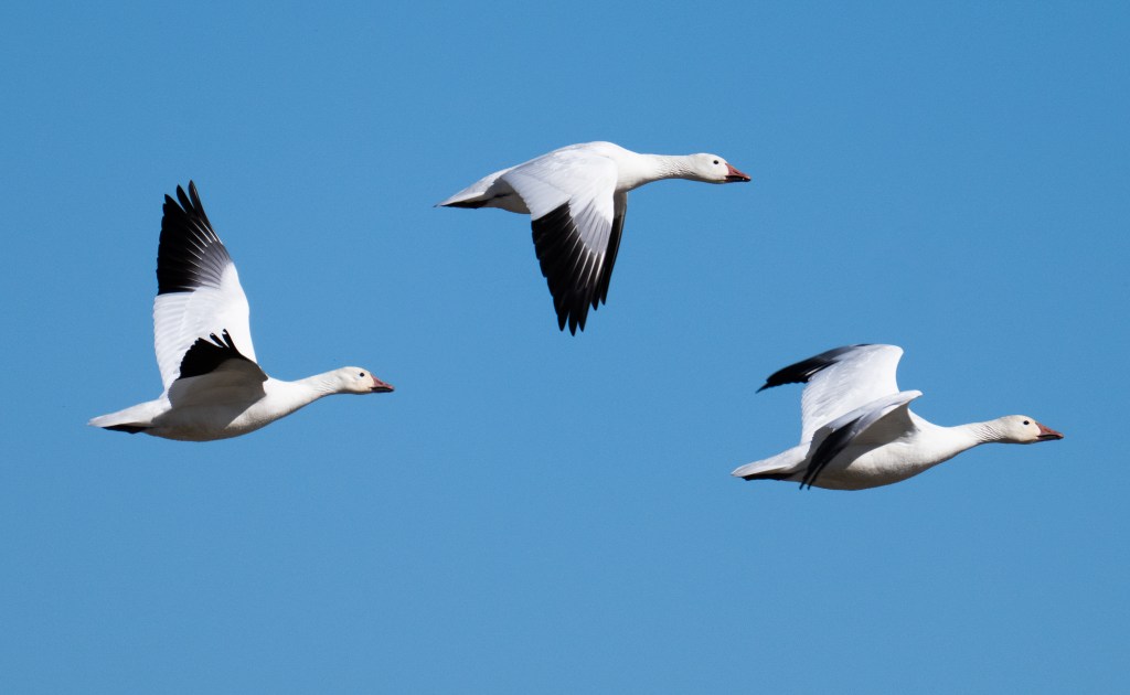
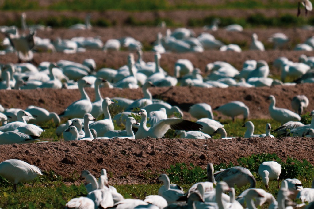
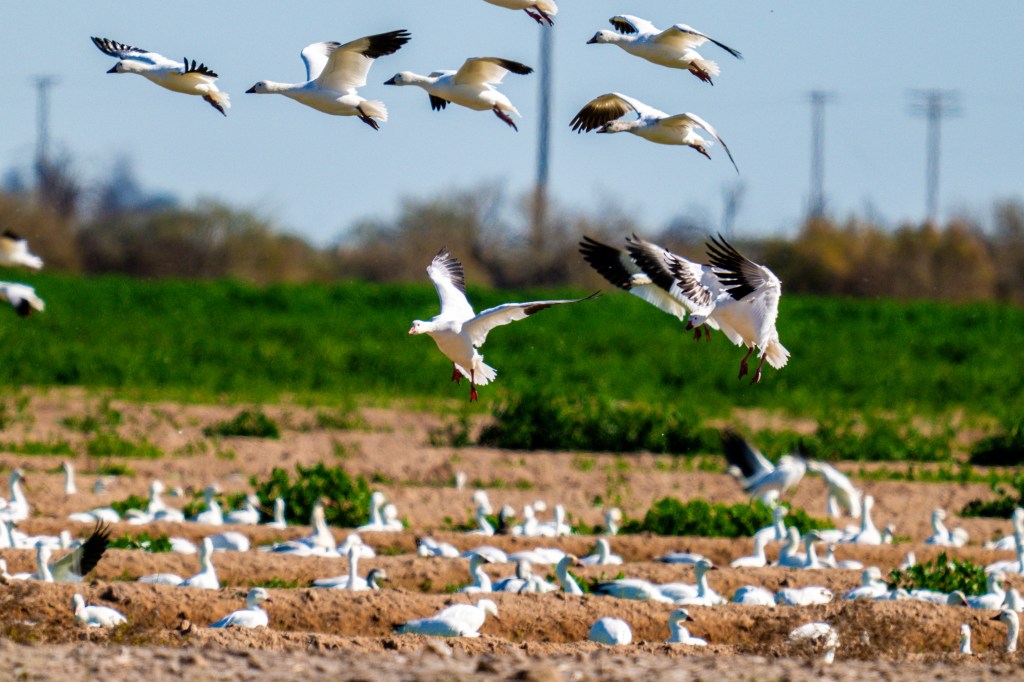
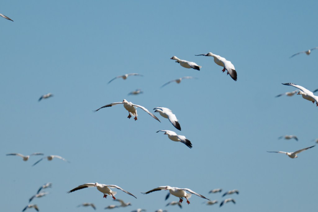
Snow geese and Ross’s geese by the thousands
White-faced ibis and long-legged shorebirds
Burrowing owls tucked into desert edges
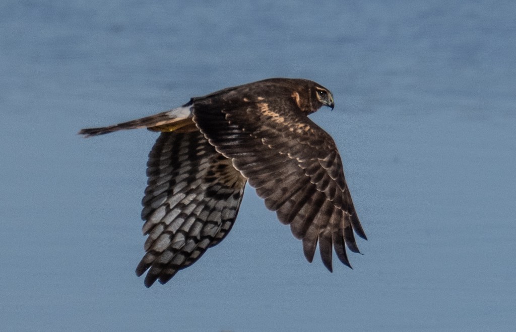
Raptors like northern harriers and peregrine falcons
Winter is especially spectacular, when migratory birds arrive in massive numbers and transform the refuge into a living, moving landscape.
Exploring the Refuge
The refuge is very visitor-friendly, with options for both casual sightseeing and serious wildlife observation.
Highlights include:
Auto tour routes that loop through wetlands and fields
Walking trails for quiet wildlife viewing
Photography pullouts perfect for sunrise and sunset light
The flat terrain and open skies make it an ideal spot for photography, especially when the mountains reflect off the water or flocks of birds fill the horizon.
Why This Refuge Matters
Despite ongoing environmental challenges facing the Salton Sea, the Sonny Bono Wildlife Refuge remains a critical lifeline for wildlife. Carefully managed water flows and habitat restoration efforts help sustain species that depend on this stopover during long migrations.
The refuge is also a powerful reminder that even altered landscapes can become essential ecosystems when conservation and stewardship come together.
Planning Your Visit
The Sonny Bono Salton Sea National Wildlife Refuge is located near Niland, California, and is open year-round during daylight hours. Cooler months—from late fall through early spring—offer the most comfortable weather and the highest concentration of wildlife.
Whether you’re a birder, photographer, or simply curious about one of California’s most unusual natural areas, the Sonny Bono Wildlife Refuge is a place that challenges expectations and rewards patience.
Bird Checklist: Sonny Bono Salton Sea National Wildlife Refuge
The refuge supports hundreds of bird species throughout the year. This checklist highlights commonly seen and notable birds, especially during peak migration and winter months.
Waterfowl
Snow Goose
Ross’s Goose
Canada Goose
Northern Pintail
American Wigeon
Green-winged Teal
Cinnamon Teal
Northern Shoveler
Ruddy Duck
Shorebirds
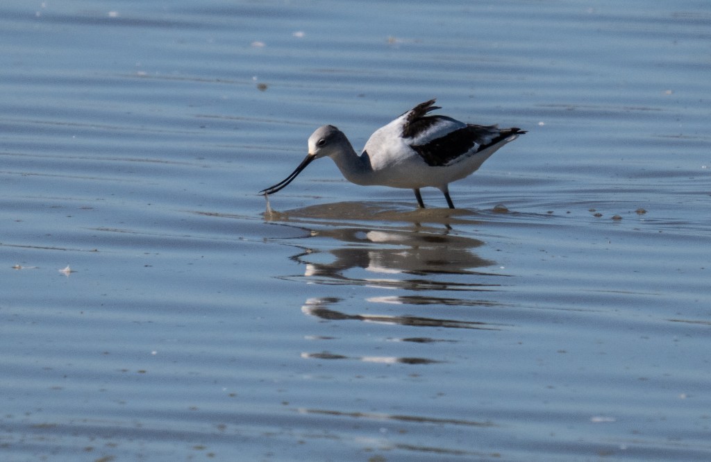
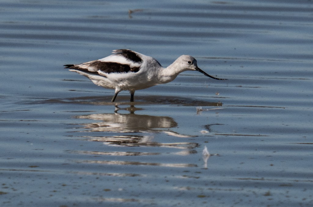
American Avocet
Black-necked Stilt
Long-billed Dowitcher
Marbled Godwit
Willet
Western Sandpiper
Least Sandpiper
Killdeer
Wading Birds
Great Blue Heron
Great Egret
Snowy Egret
Cattle Egret
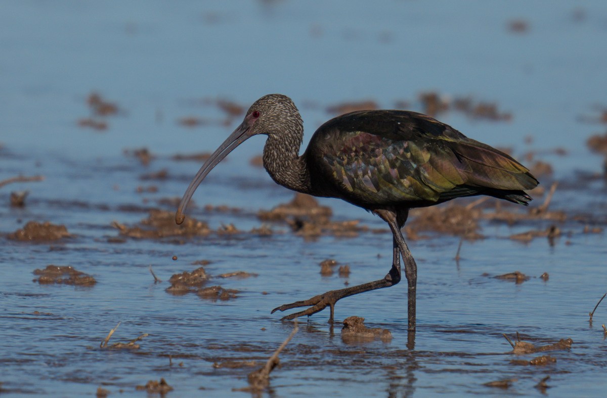
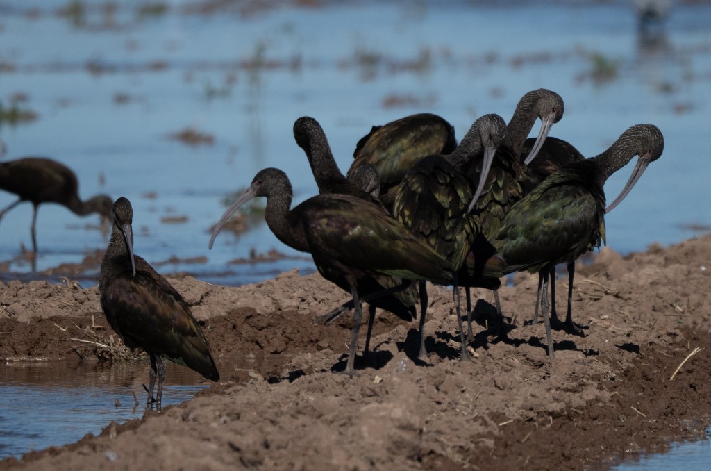
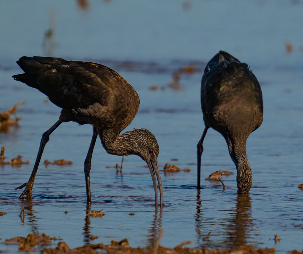
White-faced Ibis
Gulls & Terns
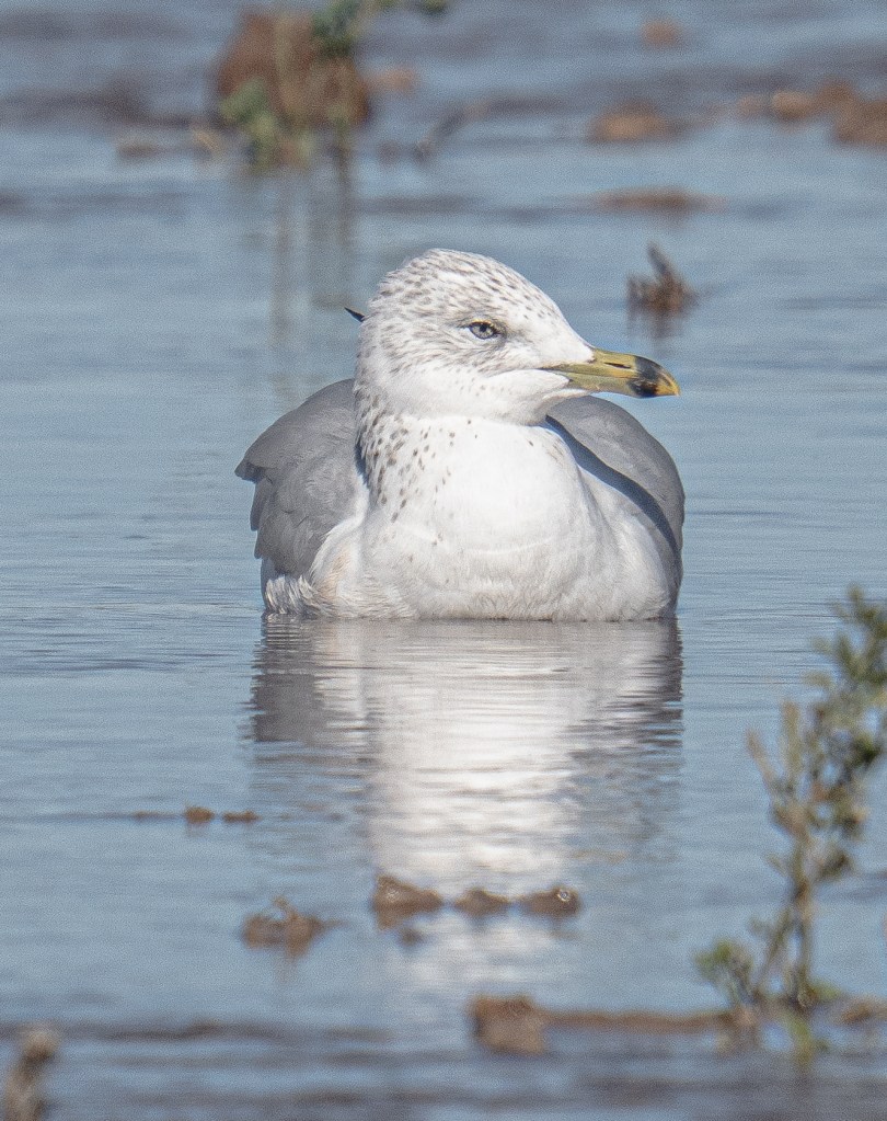
Ring-billed Gull
California Gull
Laughing Gull
Caspian Tern
Forster’s Tern
Raptors
Northern Harrier
Red-tailed Hawk
Swainson’s Hawk
American Kestrel
Peregrine Falcon
Bald Eagle (occasional but increasing)
Owls
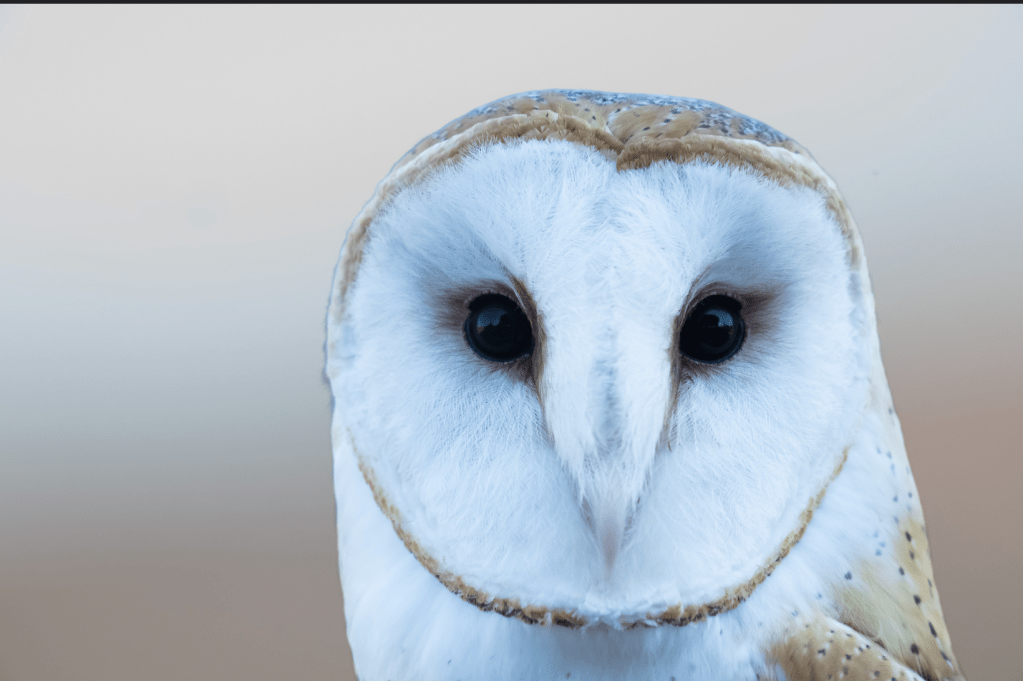
Burrowing Owl
Great Horned Owl
Desert & Upland Birds
Gambel’s Quail
Loggerhead Shrike
Greater Roadrunner
Horned Lark
Songbirds & Others
Yellow-headed Blackbird
Red-winged Blackbird
Marsh Wren
Savannah Sparrow
Say’s Phoebe
Birding tip: Winter mornings offer the best light and bird activity. Bring binoculars even if you’re just driving the auto loop—you’ll be surprised how close the birds can be.
Chollas Lake Reservoir is one of those places many locals drive past without realizing what’s inside. Beyond the busy streets and surrounding homes, the lake opens up into a surprisingly peaceful space—part urban park, part wildlife refuge, and part neighborhood gathering spot.
A Brief History of Chollas Lake
Chollas Lake was originally constructed in the early 1900s as part of San Diego’s water supply system. Over time, the reservoir evolved into a public recreation area, managed today by the City of San Diego. While it no longer serves as a primary drinking water source, the lake continues to play an important role as a community park and habitat for local wildlife.
Walking the Lake Loop
One of the most popular features of Chollas Lake is the roughly half-mile loop trail that circles the water. The path is mostly flat and paved, making it accessible for walkers, joggers, and families. Benches along the way invite visitors to slow down, sit, and watch the water—something that feels rare in a city environment.
Morning and late afternoon are especially pleasant, with cooler temperatures and softer light reflecting off the lake’s surface.
The fishing at Chollas Lake in San Diego is specifically designated for youth anglers only (ages 15 and under), meaning children can fish there for free and adults are expected to help or supervise but cannot fish themselves
The main gate at the East entrance of the park next to the lake closes 30 minutes before sunset. Other gates close BEFORE the East gate. Please note the closing time posted at your point of entry.
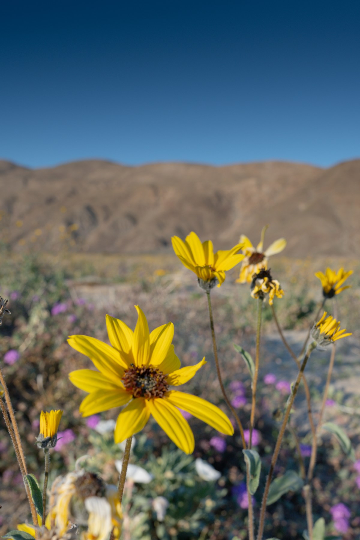
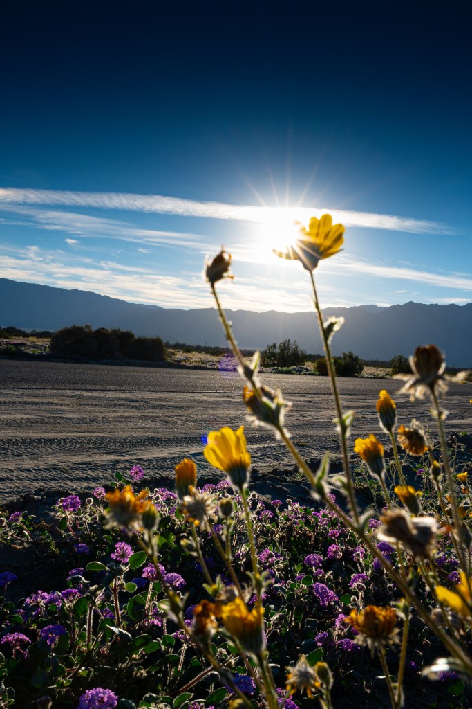
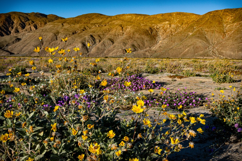
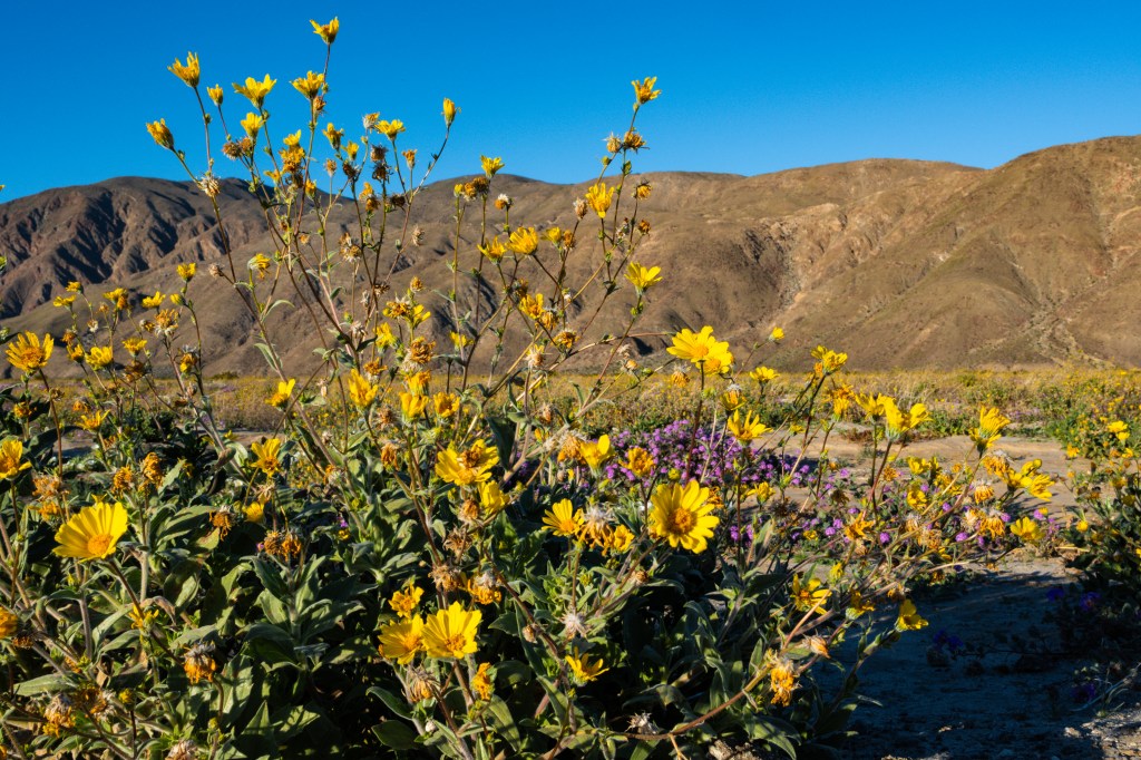
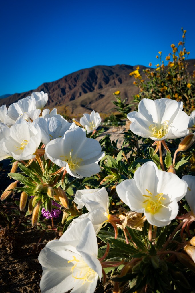
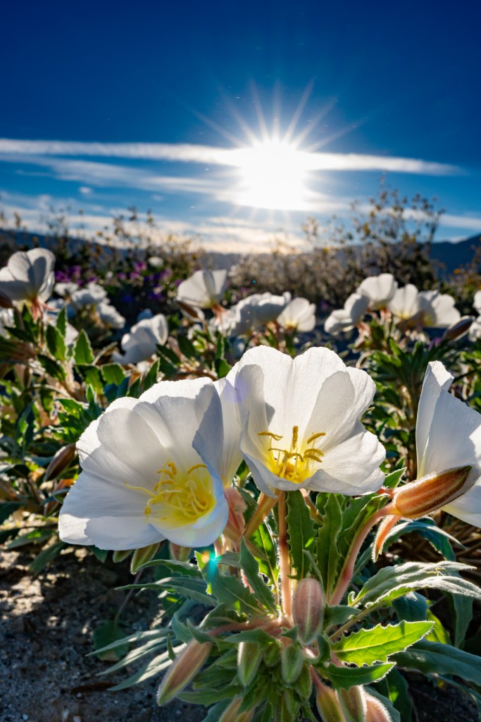
When the desert blooms, it does so on its own terms—quietly, briefly, and without guarantees. Henderson Canyon, tucked along the southern edge of Anza-Borrego Desert State Park, is one of those places where timing is everything. After a wet winter, this otherwise rocky wash transforms into a ribbon of color, drawing hikers, photographers, and wildflower chasers from across Southern California.
What Makes the Bloom Special?
Unlike the sweeping fields of flowers sometimes seen in Borrego Springs, Henderson Canyon’s bloom feels more intimate. Wildflowers appear in clusters along the wash and canyon walls, framed by ocotillo, brittlebush, and desert shrubs. In good bloom years, you might see:
Desert sunflower lining the trail
Primrose glowing pale yellow in shaded areas
Canterbury bells and sand verbena adding pops of color
Ocotillo flaming red against canyon walls later in the season
The contrast between delicate flowers and rugged rock formations is what makes Henderson Canyon especially photogenic.
A Reminder About Desert Blooms
Henderson Canyon doesn’t bloom every year, and that unpredictability is part of the magic. Some seasons offer carpets of flowers; others deliver just a few brave blossoms pushing through the sand. Either way, the hike offers sweeping desert views, quiet canyon moments, and a deeper appreciation for how resilient—and fleeting—life in the desert can be.
When Henderson Canyon does bloom, it’s not loud or showy. It’s subtle, fleeting, and unforgettable—exactly the kind of desert moment worth seeking out.
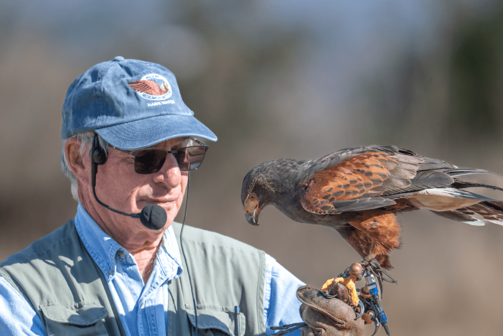
If you love wildlife, big skies, and birds of prey, the Ramona Grasslands Hawk Watch in San Diego East County offers a free, up-close way to experience some of North America’s most majestic raptors in winter. Set against the sweeping open landscapes of the Ramona Grasslands Preserve, this seasonal program draws both casual nature lovers and serious birders alike.
What Is Hawk Watch?
Upcoming 2026 Saturdays 10am to 12pm
January 3rd, 10,17, 24,31
February 7,14,21, 28
Ramona Grasslands Hawk Watch is a free weekly wildlife education event hosted by the Wildlife Research Institute (WRI) most Saturdays in January and February at Begent Ranch in Ramona. While it shares its name with traditional migration “hawk watches,” this program is more than just counting birds — it’s a hands-on learning experience for all ages
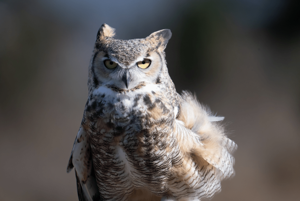
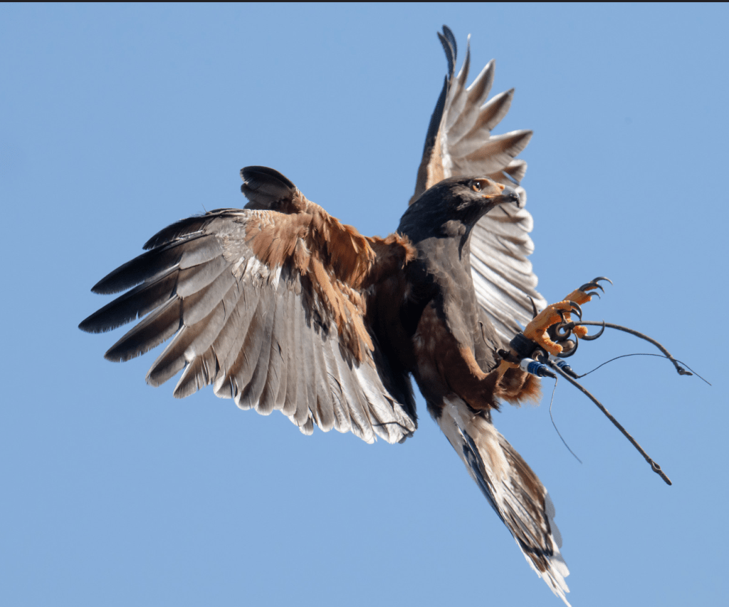
Hawk Watch is an informative educational Biologist Talk and Q& with Falconry or ambassador raptors for you to see up close and personal. The seated program lasts approximately 1.5 to 2 hours. After the presentation there is an option for additional roadside observations of wild raptors and other wildlife including bald eagle nest where you will drive your own car less than 2 miles on paved roads and come and go at your leisure.
Biologists and local expert volunteer observers will help you spot and identify birds and show them to you through our high-powered professional telescopes. In the event of rain, we will still have the educational program inside the barn, but the usual falconry flight displays will not occur in the barn. There is no hiking portion of Hawk Watch, but we recommend wearing sturdy shoes for uneven terrain and going on your own to the nearby Ramona Grassland Preserve hiking trail after the program. Hawk Watch is wheelchair accessible, and we recommend using one if walking on uneven terrain could be a safety hazard for you. We hope you can make it!
Always subject to change for special events, rentals, or closures.
Rising more than 1,300 feet above sea level, Mount Helix Park offers one of the most expansive viewpoints in East County San Diego. Located at the border of La Mesa and Spring Valley, the hilltop park provides panoramic views stretching from downtown San Diego to the Pacific Ocean and east toward the region’s rugged inland terrain.
Mount Helix itself got its name from the helix aspersa snail once found on the hill, a local naturalist curiosity at the time. At the summit sits a stone amphitheater that has served as a community gathering place for decades. The site is best known for its annual Easter sunrise service, along with concerts and civic events held throughout the year. A large cross, visible from miles away, stands near the amphitheater and remains a prominent—if sometimes controversial—feature of the park.
Mount Helix Park is easily accessible by car, with a short paved walkway leading from the parking area to the top. While the park does not offer extensive hiking trails, its accessibility and unobstructed views make it a popular destination for photographers, sightseers, and locals seeking a quiet overlook.
Clear days offer visibility across much of San Diego County, while sunset brings changing colors and city lights that make the park especially popular in the evening hours. Despite its modest size, Mount Helix Park continues to be one of East County’s most recognizable and frequently visited viewpoints.
55th Annual San Diego Bay Parade of Lights: Where the Holidays Meet the Harbor
Meta description: Celebrate the 55th Annual San Diego Bay Parade of Lights—best viewing spots, photography tips, and why this waterfront tradition remains a holiday favorite.
Suggested categories: San Diego Events, Holiday Traditions, Coastal Photography
Suggested tags: San Diego Bay Parade of Lights, San Diego Christmas, Holiday Lights San Diego, Waterfront Events, Night Photography
San Diego’s signature holiday tradition returns to the waterfront, transforming the bay into a moving festival of color, music, and maritime creativity.
A Holiday Tradition on the Water
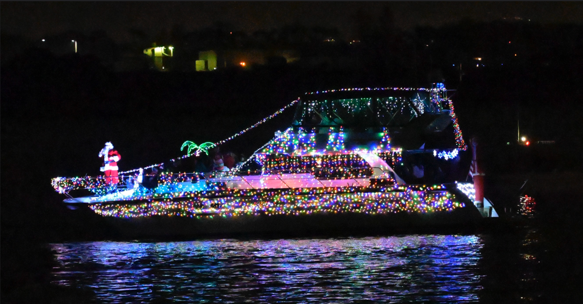
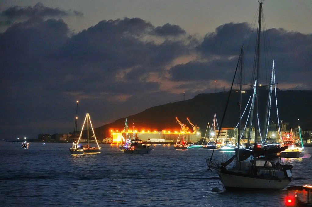
For more than five decades, the San Diego Bay Parade of Lights has marked the start of the holiday season with a spectacle found nowhere else in Southern California. Now in its 55th year, the parade brings together dozens of privately owned boats—each decorated from bow to stern in synchronized lights and themed displays—that glide across the bay after sunset.
What makes this event special isn’t just the scale of the decorations, but the setting itself. With the downtown skyline, Coronado Bridge, and working harbor as a backdrop, the parade captures the essence of San Diego: festive, coastal, and community‑driven.
How the Parade Works
Participating vessels line up along the bay and follow a designated route that allows spectators on both sides of the water to enjoy the show. Boats range from small sailboats to large yachts, all competing for top honors in categories such as best overall decoration, originality, and best use of lights.
The parade traditionally runs on two consecutive weekend nights, giving locals and visitors multiple chances to experience it. Each evening culminates with a slow, scenic procession that keeps the boats visible long enough for photos, cheers, and the occasional holiday sing‑along.
The San Diego Bay Parade of Lights brings more than 100,000 San Diego residents and visitors to the shores of San Diego Bay each year. The procession of approximately 80 lavishly decorated boats has become one of the most iconic events in the region. There is no cost to view the parade.
2025 Parade Theme is Out of This World
The procession will start at 5:30 p.m. and will follow the predetermined parade route.
The APPROXIMATE arrival time of the parade at various locations are:
Shelter Island (start of parade) 5:30 p.m.
Harbor Island 5:45 – 6:15 p.m.
Seaport Village 6:20 – 6:45 p.m.
The Embarcadero 6:50 – 7:15 p.m.
The Pier at Cesar Chavez Park 7:20 – 7:30 p.m.
Ferry Landing on Coronado 7:40 p.m.
Best Places to Watch (and Photograph)
One of the parade’s strengths is accessibility. You don’t need a ticket to enjoy it—just a good vantage point.
Popular viewing locations include:
Seaport Village & the Embarcadero – Ideal for wide shots that include boats and skyline reflections.
Shelter Island – A favorite for photographers, offering unobstructed views and calmer crowds.
Coronado Ferry Landing – Perfect for capturing boats with Coronado lights in the background.
Cesar Chavez Park – A relaxed setting with room to move and frame different angles.
For photography, arrive early to claim a spot and plan to shoot through blue hour, when the remaining daylight blends with the glow of the lights on the water.